Rain Continues Today, Colder into Midweek
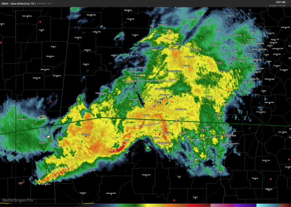
Clouds and rain blanket much of the Southeast US this morning with a surface low center located over northern Mississippi and forecast to move east-southeast to the Southeast US Coast late tonight. Temperatures were in the 50s over all of Alabama with the exception of Mobile which was at 63 degrees. Rain is likely to continue over the area off and on through much of the day and into the evening hours with temperatures in the upper 50s and lower 60s.
The trough at 500 millibars will be located over Missouri around 1 pm today. Remember, 18z is now 1 pm since with the jump to Daylight Saving Time the time difference between CDT and Z is now 5 hours. At the surface, the surface low will move east-southeast reaching just off Savannah, GA, by 1 am Monday. This should bring an end to the rain across Alabama into the early morning of Monday.
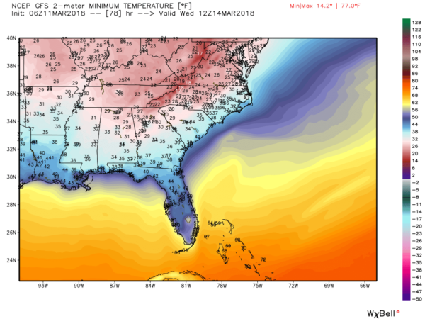
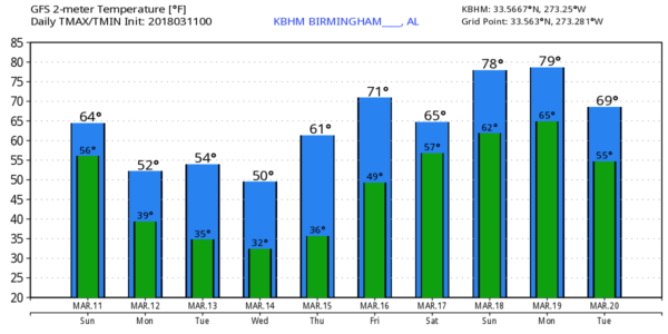
The upper closed low will dig a deep trough into the eastern US by Monday turning our temperatures sharply colder with lows Monday near 40 and highs in the lower 50s.
The deep trough over the eastern US will remain in place from Tuesday through Thursday keeping us in chilly air as the surface high gradually settles from the Central Plains into the Southeast US by Friday. This will bring us three rather chilly mornings for Tuesday, Wednesday, and Thursday as morning lows drop into the range of the upper 20s to lower 30s. Another freeze warning may be necessary during this time period.
By Friday we begin to come under the influence of an upper ridge moving out of the Central US, so we should see a pretty quick warm up with highs on Friday and the weekend climbing well into the 70s. Unfortunately, it’s looking somewhat wet again as the upper flow transports moisture out of the Pacific and into the Southeast US. Right now it looks like we’ll have a fairly good chance to see widespread showers in Alabama.
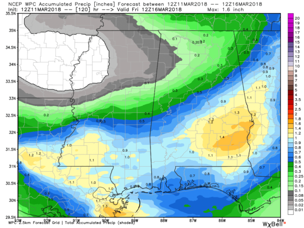
Rainfall for the rest of today before ending early Monday morning could amount to an additional 1.5 inches in Southeast Alabama dropping off to the northwest to less than a quarter of an inch in the northwest counties.
Looking out into voodoo country, the pattern begins with a strong trough moving across the Ohio River Valley around the 20th of March before a substantial ridge moves over the eastern half of the country that maintains itself through March 25th or so. A very strong upper trough moves out of the Southwest US into the Ohio River Valley in the 25th/26th time frame. So the pattern remains active and could be pretty wet for the southern US due to Pacific moisture coming into the Lower Mississippi River Valley.
Beach Forecast: Click here to see the AlabamaWx Beach Forecast Center page.
WeatherBrains: Don’t forget you can listen to our weekly 90 minute netcast anytime on the web, or on iTunes. This is the show all about weather featuring many familiar voices, including our meteorologists here at ABC 33/40.
James Spann will be back with the next edition of the Weather Xtreme Video first thing on Monday morning. Stay dry today and make sure you set all of your clocks ahead one hour so you won’t be late for anything today! Have a great day and Godspeed.
-Brian-
.
Category: Alabama's Weather, ALL POSTS, Weather Xtreme Videos


