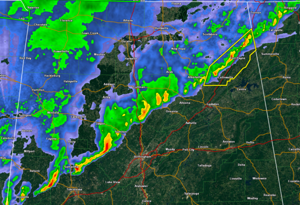
Strong Storms Dropping Into the Birmingham, Tuscaloosa and Gadsden Areas
A line of strong storms is pushing eastward across North Central Alabama this morning.
At 7:35 a.m., they extend from Fort Payne in Northeast Alabama southwestward just to the west of I-59 through Marshall, Blount, northwestern Jefferson, Tuscaloosa and Pickens Counties.
The storms will be crossing I-59 over the next hour, bringing heavy rain and wind gust to 50 mph in spots. There is not much if any lightning with the storms.
A severe thunderstorm is over DeKalb County in Northeast Alabama, with rotation indicated in some of the storms, so the National Weather Service is monitoring in case a tornado warning is necessary for that storm.


