Flood Watch In Effect For North Alabama Through This Afternoon
…FLOOD WATCH REMAINS IN EFFECT THROUGH THIS AFTERNOON…
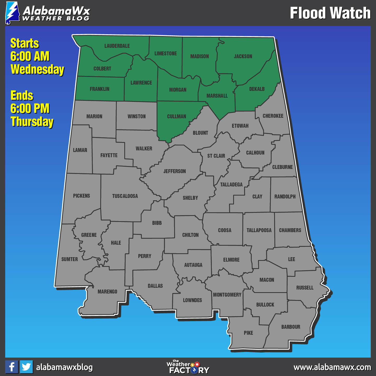
The Flood Watch continues for
* Portions of Alabama and southern middle Tennessee, including
the following areas, in Alabama, Colbert, Cullman, De Kalb,
Franklin AL, Jackson, Lauderdale, Lawrence, Limestone,
Madison, Marshall, and Morgan. In southern middle Tennessee,
Franklin TN, Lincoln, and Moore.
* Through this afternoon.
* Multiple periods of moderate to heavy rainfall will impact the
area through this afternoon. Additional rainfall of 1 to 2
inches will bring totals up to 2 to 5 inches. The heaviest rain
totals will occur in southern middle Tennessee and along the
Alabama-Tennessee state line.
* With area rivers and streams already running high combined
with the saturated soils, it will not take much rain for areal
and river flooding of low lying areas and some roadways to
occur. Do not drive through water that is covering a road.
PRECAUTIONARY/PREPAREDNESS ACTIONS…
A Flood Watch means there is a potential for flooding based on
current forecasts.
You should monitor later forecasts and be alert for possible
Flash Flood or Flood Warnings. Those living in areas prone to
flooding should be prepared to take action should flooding
develop.
Category: ALL POSTS, Archived Warnings
About the Author (Author Profile)
Scott Martin is an operational meteorologist, professional graphic artist, musician, husband, and father. Not only is Scott a member of the National Weather Association, but he is also the Central Alabama Chapter of the NWA president. Scott is also the co-founder of Racecast Weather, which provides forecasts for many racing series across the USA. He also supplies forecasts for the BassMaster Elite Series events including the BassMaster Classic.Subscribe
If you enjoyed this article, subscribe to receive more just like it.


