Strong Storms Affecting Parts of Jackson, & Madison Counties
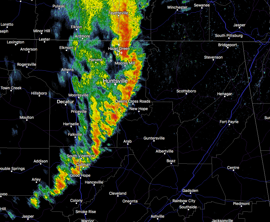
Heads up if you are in the path of this storm. Strong gusty winds, dangerous lightning, and very heavy rainfall can be expected.
Special Weather Statement
National Weather Service Huntsville AL
1134 AM CST THU FEB 22 2018
ALZ006-009-TNZ096-097-221815-
Madison AL-Jackson AL-Franklin TN-Lincoln TN-
1134 AM CST THU FEB 22 2018
…SIGNIFICANT WEATHER ADVISORY FOR NORTHWESTERN JACKSON…
NORTHEASTERN MADISON…SOUTHEASTERN LINCOLN AND SOUTHERN FRANKLIN
COUNTIES UNTIL 1215 PM CST…
At 1134 AM CST, Doppler radar was tracking a strong thunderstorm over
New Market, or near Moores Mill, moving east at 40 mph.
Winds in excess of 40 mph will be possible with this storm.
Locations impacted include…
Winchester, Moores Mill, Meridianville, Hazel Green, Cowan, Huntland,
New Market, Lincoln, Hytop and Bass.
PRECAUTIONARY/PREPAREDNESS ACTIONS…
Strong gusty winds will be capable of knocking down small tree limbs
along with other small unsecured items. Seek safe shelter until this
storm has passed.
Category: Alabama's Weather, ALL POSTS
About the Author (Author Profile)
Scott Martin is an operational meteorologist, professional graphic artist, musician, husband, and father. Not only is Scott a member of the National Weather Association, but he is also the Central Alabama Chapter of the NWA president. Scott is also the co-founder of Racecast Weather, which provides forecasts for many racing series across the USA. He also supplies forecasts for the BassMaster Elite Series events including the BassMaster Classic.Subscribe
If you enjoyed this article, subscribe to receive more just like it.


