A Quick Look At Our Weather Just After Midday
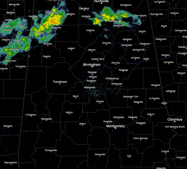
Nearly all of Central Alabama is dry at this point, with the only shower activity showing up in the extreme north and northwestern parts of the area. Some decent rainfall is occurring over much of Marion County and also into the northern parts of Lamar County and the western parts of Winston County. Showers just moved out of Cullman County and there are a few very light showers or sprinkles showing in the northeastern parts of Blount County. These are moving to the northeast.
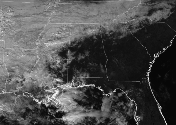
For the rest of the area, skies are mostly clear as the rest of the cloud cover associated with this system is located to our north and to our west. There is a big range of temperatures across the area due to the differences in cloud cover and warm air advection taking place. We are in the upper 40s in the northwestern parts of Central Alabama, with mid-70s down in the southeast. Birmingham was at 63 degrees at 12:50 PM, with the cool spot being Haleyville at 48 degrees. Eufaula, Troy, and Selma are all tied as the warm spots at 75 degrees.
We’ll continue to have scattered to numerous showers move in over the northern parts of Central Alabama throughout the remainder of the afternoon hours, with some activity developing to the south within the next couple of hours. There will be no surface-based instability according to the latest HRRR model run, and thunder may be limited to the extreme southern parts of the area. The activity then all shifts to the southern half of the area for the evening through the late night hours while the northern half gets a small break from the rain. Afternoon highs will top out in the mid-50s to the upper 70s from the northwest to the southeast. Heavier showers and thunderstorms will move in during the overnight hours, but no severe weather is expected. Overnight lows will range throughout the 50s. Rainfall amounts through 5:00 AM on Wednesday morning will range from around 1/4-inch in the extreme eastern parts of the area, to around 2 inches near the Mississippi state line in the western and northwestern parts of the area.
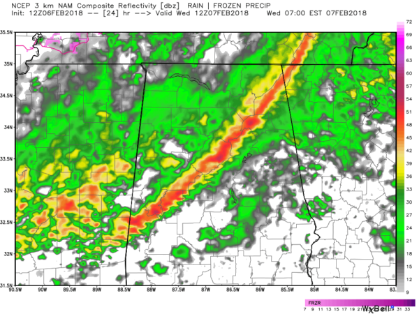
Wednesday will start off with a line of showers and thunderstorms pushing through the northwest and central parts of the area prior to the rush hour and will push into the Montgomery area by 8AM-10AM time frame. Behind that, light rainfall will continue across the area before eventually being pushed out of the area starting around midnight. All rain should be out of nearly all of Central Alabama before daybreak on Thursday, but a few showers and sprinkles could linger into the morning in the southeastern parts. Once again, severe weather is not expected as surface-based instability will be very limited. Wednesday’s highs will be in the lower 50s to the lower 70s from northwest to southeast, while lows will bottom out in the upper 20s to the lower 40s. Rainfall amounts by 6:00 AM on Thursday morning could be in the 1 to 2-1/4 inch range, with some locally higher amounts. We need every drop we can get at this point, due to nearly all of Central Alabama being in some form of drought conditions.
Category: Alabama's Weather, ALL POSTS


