A Brief Update At 4:00 PM
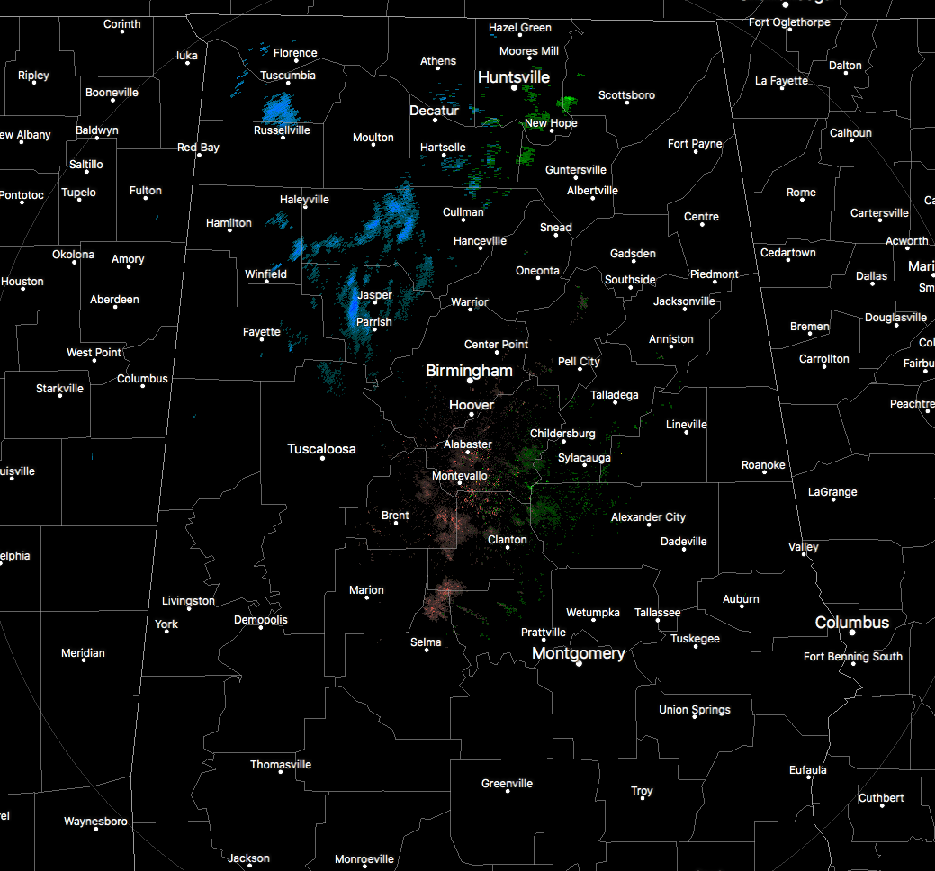
Radar trends are continuing to show lighter returns on the backside of the moisture that is currently moving through the northwestern and north-central parts of Alabama. A few flurries have been reported as far south as Demopolis, but most of the snowfall will stay north of the I-20 corridor for the next few hours. Back to the west in northern Mississippi, much of the snowfall has come to an end with only some flurries falling at this point.
Temperatures at this point are ranging from the lower 20s in the northwest to the upper 50s in the southeast. By the time we reach sunrise on Saturday morning, our lows will range from the upper teens to the upper 20s with mostly cloudy skies.
The good news at this point is that there have been no travel problems in North/Central Alabama… but that can’t be said in neighboring states. Just west of Nashville on I-40, a massive wreck involving 24 vehicles has the interstate shut down at mile marker 120. At this point, there is no word on injuries. Slick roads are also being reported in parts of Mississippi, making it hard for emergency vehicles to get to the problem areas.
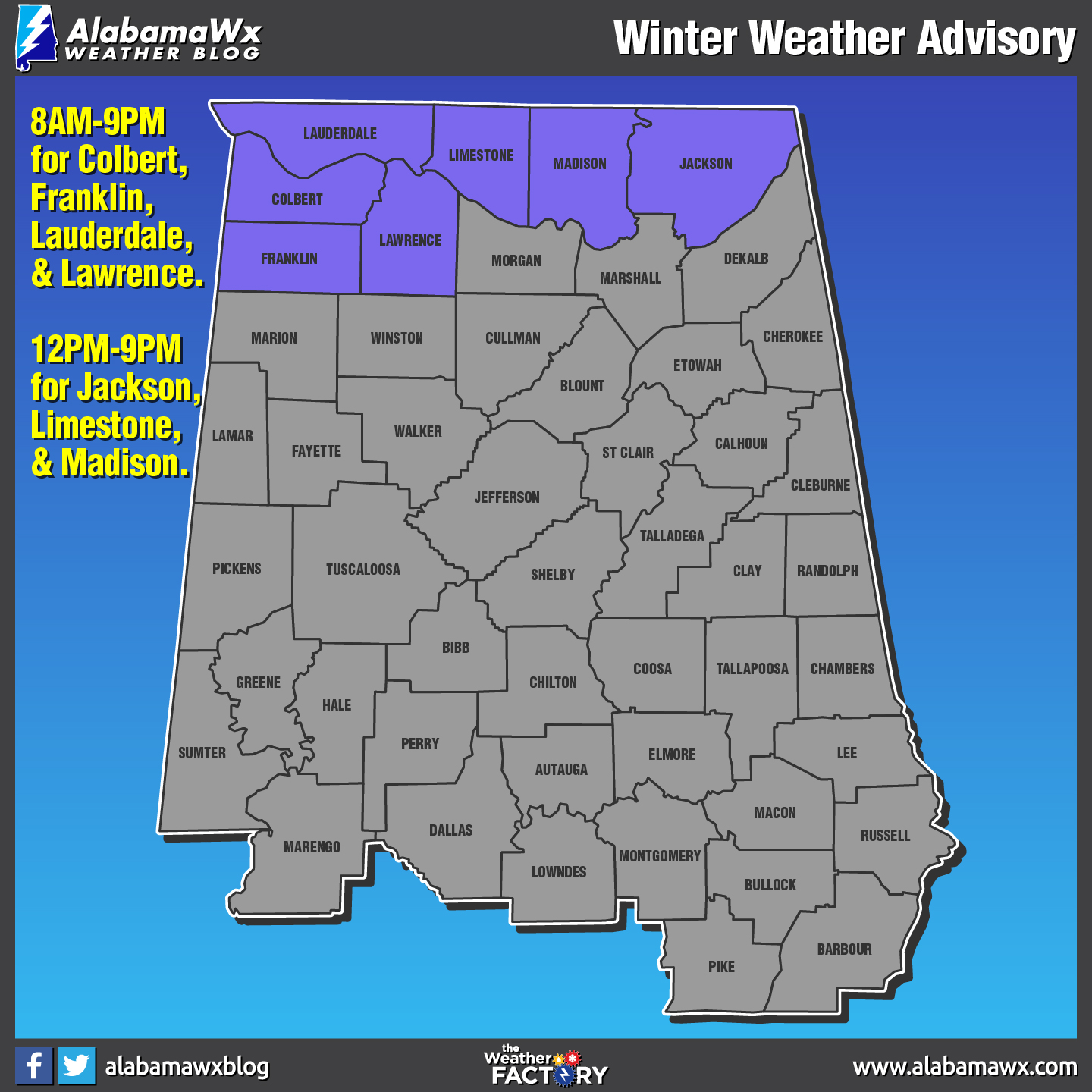
As the temperatures continue to drop, a few slick spots could form out there on some elevated surfaces and lesser driven roadways mainly in the extreme northern and northwestern counties in Alabama. NWS Huntsville continues a Winter Weather Advisory for Colbert, Franklin, Jackson, Lauderdale, Lawrence, Limestone, and Madison counties until 9:00 PM tonight for the small risk of any icy accumulations on those surfaces.
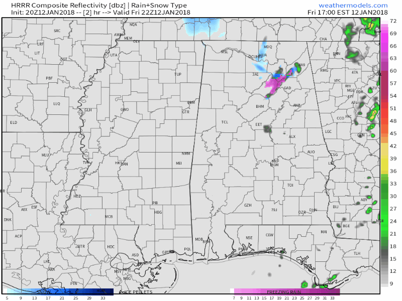
This is the HRRR Simulated Radar from 4:00-10:00 PM tonight and it shows that the wintry precipitation quickly exits the state within the next couple of hours.
Category: Alabama's Weather, ALL POSTS
About the Author (Author Profile)
Scott Martin is an operational meteorologist, professional graphic artist, musician, husband, and father. Not only is Scott a member of the National Weather Association, but he is also the Central Alabama Chapter of the NWA president. Scott is also the co-founder of Racecast Weather, which provides forecasts for many racing series across the USA. He also supplies forecasts for the BassMaster Elite Series events including the BassMaster Classic.Subscribe
If you enjoyed this article, subscribe to receive more just like it.


