Weather By The Numbers: December Snow Edition
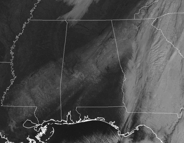
We had quite the spread of snowfall amounts from Friday’s snow event, one in which overperformed what everyone was expecting. Places where you expect snow to fall received none at all, while some places who you think wouldn’t get snow, did. We’ll start of this edition with a top ten of the highest snowfall totals from across Central Alabama, with a few of these coming as quite the surprise…
1. Jacksonville (Calhoun)… 12.0 in
2. Anniston (Calhoun)… 10.0 in
3. Fosters Crossroads (Randolph)… 10.0 in
4. Ashland (Clay)… 9.1 in
5. Mars Hill (Cleburne)… 9.0 in
6. Wedowee (Randolph)… 8.0 in
7. Oxford (Calhoun)… 8.0 in
8. Ballantrae (Shelby)… 7.7 in
9. Weaver (Calhoun)… 7.3 in
10. Joe Tucker Park (Shelby)… 7.0 in
If we take a look at the Snow to Liquid Equivalent (amount of liquid precipitation that is produced after melting snow) for Friday’s event, it would show that the actual amount of liquid would equal a nearly typical rain event for Central Alabama. The ratio for the event ended up close to 10/1, meaning that 10 inches of snow would equal 1 inch of liquid precipitation.
If the cold air was not in place over Central Alabama, these would be the rainfall totals for the event…
1. Jacksonville (Calhoun)… 1.20 in
2. Anniston (Calhoun)… 1.00 in
3. Fosters Crossroads (Randolph)… 1.00 in
4. Ashland (Clay)… 0.91 in
5. Mars Hill (Cleburne)… 0.90 in
6. Wedowee (Randolph)… 0.80 in
7. Oxford (Calhoun)… 0.80 in
8. Ballantrae (Shelby)… 0.77 in
9. Weaver (Calhoun)… 0.73 in
10. Joe Tucker Park (Shelby)… 0.70 in
As much of Central Alabama is now running below average in rainfall for the year, with much of the area with abnormally dry conditions and some in a moderate drought, we could use any moisture we can get.
Here are a few more numbers to throw out there for this post…
65.13 … percentage of the state with abnormally dry conditions
13.32 … percentage of the state in moderate drought conditions
4.0 … inches of snowfall for the Birmingham International Airport
6.0 … highest snowfall total (inches) in Jefferson County (Trussville).
7.0 … highest snowfall total (inches) in Shelby County (Joe Tucker Park).
4 … out of the top-10 snowfall totals were recorded in Calhoun County.
1997 … last time Birmingham received measurable snow in December.
8.0 … inches of snow that fell in Birmingham on Dec. 31, 1963, largest December snow for the city.
3rd … where Friday’s snow event ranks in all-time snow records for December in Birmingham.
1.0 … amount of snow (inches) recorded at the Mobile Airport (by NWS employee).
41 … Friday’s high temperature for Mobile, tying the record low maximum for the date (recorded at 2:10 AM).
3 … number of counties in the NWS Huntsville area that received measureable snowfall (Cullman, DeKalb, and Marshall).
2.0 … snowfall (inches) recorded in Crossville in DeKalb County, highest total from NWS Huntsville area.
Category: ALL POSTS, Met 101/Weather History


