Noon Notes on Nate
Here are some notes on Hurricane Nate as we approach the noon hour…
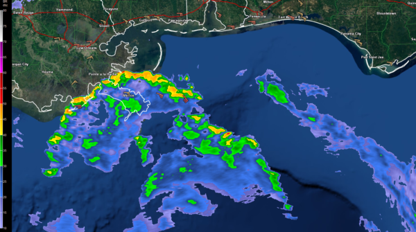
…Outer bands of Nate are now visible from the NWS radars at New Orleans and Mobile.
…The Air Force plane’s most recent penetration measured a central pressure of 983 millibars. Flight level winds were 97 mph with an SFMR instrument surface wind estimate of sustained 74 mph winds. The plane is on an inbound leg now and we will have wind readings from the western side of the storm and a new central pressure reading.
…The Air Force Hurricane Hunters relocated to Houston since their base at Keesler in Biloxi is in the impact zone.
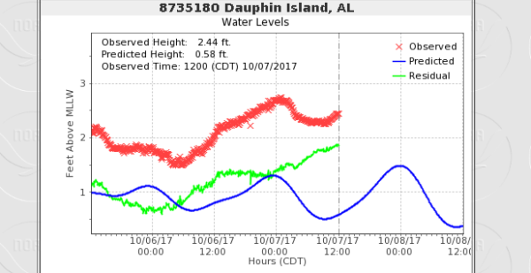
…Tides are already running 1-2 feet above normal along the northern Gulf Coast. Dauphin Island is measuring an observed height of 2.42 feet against the normal of 0.56′. High tide at DI is at 11:50 pm tonight. Pensacola high tide is at 12:19 a.m. early Sunday morning. Tides are already nearly two feet above normal there. At the Mobile State Docks, they are running 1.71 feet above normal. High tide there is at 1:46 a.m. early Sunday.
…Storm surge is expected to reach
…Winds at Gulf Shores are easterly at 23 gusting to 32 mph. The barometer is down to 29.85 inches.
Other reports:
Destin…gusts to 25 mph
Pensacola…easterly winds sustained at 15 mph
Brookley Field: winds E at 12
Mobile Regional Airport: winds E at 12
…The SPC has issued a slight risk for severe weather today for coastal Mississippi, Alabama and Northwest Florida. A marginal risk extends up into Marengo, Dallas and Wilcox Counties through the early morning hours.
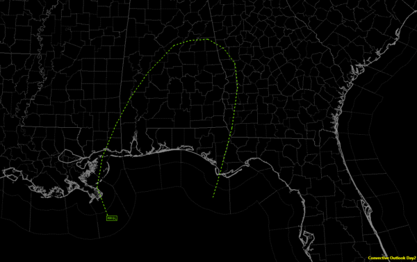
The Day Two shows a marginal risk up into Shelby, Talladega and Clay Counties.


