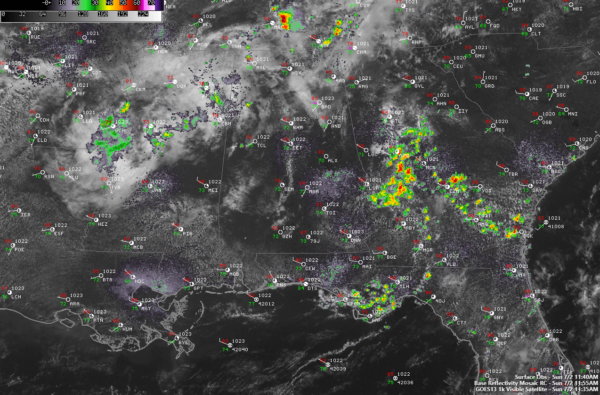
Sunday Late Morning Update; Eye on the Tropics
Just got through updating the seven day forecast. No changes necessary to Scott Martin’s excellent forecast from early this morning.

Have been watching a faltering (almost said tracking there!) area of showers moving through Mississippi this morning. I think it is actually two disturbances. The trailing one has the best potential to bring an area of showers and storms to Central Alabama later this afternoon and this evening.
The current HRRR short term model doesn’t have a good handle on the precipitation area, so I am skeptical of it still having any showers or storms with it when it gets here this afternoon. But there is a good bit of heat and humidity and increasing, although modest instability, so you gotta figure there will be a few showers and storms with it.
Convective temperatures are warm due to the warm temperature profiles aloft, so heating won’t probably do it by itself.
Winds aloft are about as low as they get by themselves, so the disturbance will have to bring its own slightly better winds to stir the atmosphere enough for any storms to hold together at all. If they manage to, there is a good bit of dry air in the mid levels of the atmosphere, and then can increase the danger of downbursts developing, which can cause damaging winds.
One such downburst in Tuscaloosa County yesterday afternoon in the Fosters community produced a downburst that caused an estimated 60 mph wind. There was even a report that there may have been a small gustnado, or tornado that formed along the gust front.
Looks like another possible eddy and round of storms at some point tomorrow and on the Fourth. Look for a better chance Thursday into Friday as a stronger trough zips by.
Our eyes will be on the tropics by midweek as a disturbance threatens to form in the Main Development Region of the Atlantic between the Antilles and the Cape Verde Islands. This system could become a named storm during the week. If it does, it would impact the northeastern Caribbean next weekend and could post a threat to the U.S. East Coast by the following week.
Category: Alabama's Weather, ALL POSTS


