A Quick Look At Our Weather At Midday
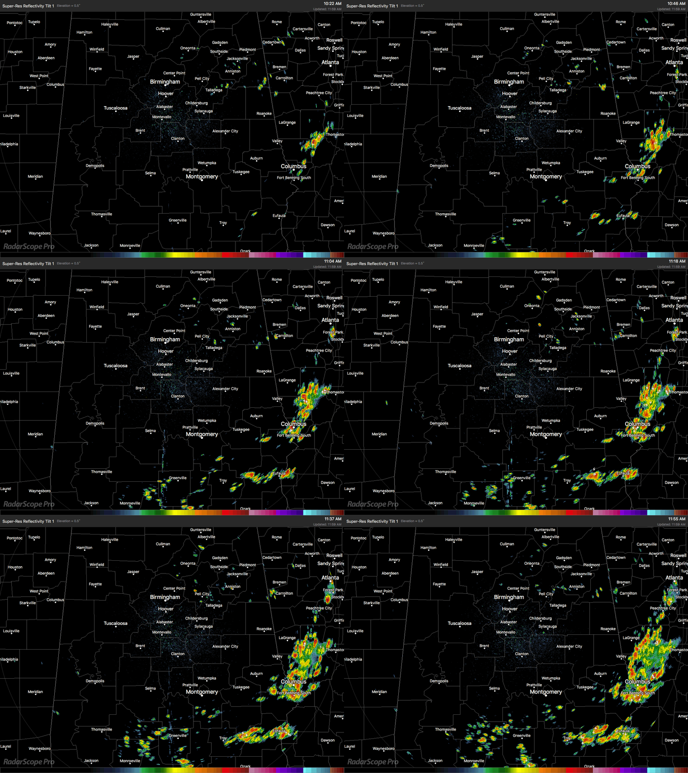
RADAR CHECK AT 12:00PM
For much of Central Alabama at the midday hour, conditions are very warm and very humid. Some places are already experiencing scattered showers and storms, especially down in the southeastern parts of the area. There are also a few isolated showers that have popped up in the northeastern part of the area, especially east of I-65 and north of I-20. This will be the expected trend throughout the remainder of the daytime hours, as more showers and storms will develop with the heating of the day.
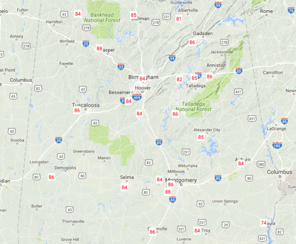
TEMPERATURES AT MIDDAY
At 12:08 PM, temperatures are in the mid to upper 80s across much of Central Alabama, with the exception of down in the southeastern corner where heavy rainfall has been falling. Eufaula is down to 74 degrees thanks to the rainfall, and is easily the coll spot across the area, while just up the road in Montgomery, it is 88 degrees, making it the warm spot.
FOR THE REST OF THE DAY
There will be a mix of sun and clouds with scattered showers and thunderstorms continuing to develop during the daylight hours. With precipitable water values in the 1.50 to 2.00 inch range, development will be likely and totals could be heavy if you are caught under a shower or storm. Afternoon highs will top out in the mid to upper 80s across Central Alabama, with a couple of locations hitting 90 degrees. Showers and storms will begin to dissipate as the sun goes down tonight, but I wouldn’t be surprised if one or two continue into the late night and overnight hours. Lows will only drop down into the upper 60s to the lower 70s.
TOMORROW WILL BE A NEAR CARBON COPY OF TODAY
Tuesday’s weather will be pretty similar to what today has in store, but the only difference is that precipitable water values will be a tad lower of the northern half of Central Alabama, in the 1.25 to 1.50 inch range, while the southern half will continue to hold on to the values close or just over 2.00 inches. Therefore, scattered to numerous showers will be more likely in the southern half of Central Alabama, while the northern half could enjoy a mostly dry day with only a few isolated to scattered showers. Highs will once again be in the mid to upper 80s.
A LOOK AT THE TROPICS
At this point all remains quiet, but we have been watching the GFS as it has been consistently hinting at some type of tropical development over the western Caribbean and into the southwestern Gulf of Mexico for within the next 7-10 days. It has also showed that troughing could bring this feature northward towards Louisiana and the Southeast. If it develops into a tropical storm, it would be Bret, but as of now it doesn’t look to be a strong system. It could bring even more rainfall to the coastline, along with dangerous rip currents. We’ll keep an eye on this to see if the GFS is right.
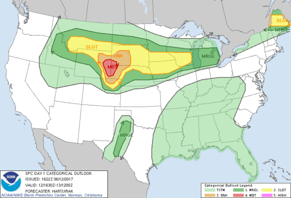
ANY SEVERE WEATHER POSSIBLE IN THE UNITED STATES?
The answer to that question is… yes. Severe thunderstorms with tornadoes, very large hail, and damaging winds are likely this afternoon into tonight across the north-central High Plains. Other severe thunderstorms are expected from parts of the northern Rockies to the Upper Midwest, as well as across Maine and west Texas this afternoon into evening.
HEADING TO THE BEACH
For a detailed look at the weather from Fort Morgan over to Panama City Beach, click here to see the AlabamaWx Beach Forecast Center page. The Beach Forecast is partially underwritten by the support of Brett/Robinson Vacation Rentals in Gulf Shores and Orange Beach. Click here to see Brett/Robinson’s Own Your Summer specials now!
TODAY IN WEATHER HISTORY
June 12, 1989 – Thunderstorms produced severe weather from Tennessee Valley to the Central Appalachians in the afternoon and evening, and produced severe weather in Oklahoma and Texas during the evening and night. Thunderstorms spawned ten tornadoes, and there were 164 reports of large hail and damaging winds. Thunderstorms produced wind gusts to 100 mph at Amarillo, TX, and wind gusts to 110 mph at Denton TX. Hail three inches in diameter was reported at Tucumcari NM.
WEATHERBRAINS: Great show on tap for this week with Lans Rothfusz from the National Severe Storms Laboratory talking about progress on the new severe weather warning paradigm called FACETS. Lans will also update us on Warn on Forecast. Check out the show at www.WeatherBrains.com. You can also subscribe on iTunes. You can watch the show live at live.bigbrainsmedia.com. You will be able to see the show on the James Spann 24×7 weather channel on cable or directly over the air on the dot 2 feed.
Category: Alabama's Weather, ALL POSTS


