
Two Separate Flood Advisories Now In Effect For Parts of Central Alabama
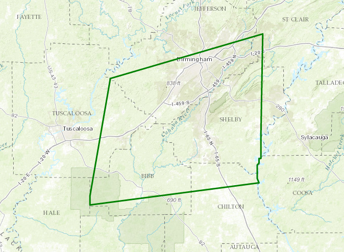
The National Weather Service in Birmingham has issued a Urban and Small Stream Flood Advisory for Poor Drainage Areas for Northeastern Chilton, Southeastern Tuscaloosa, Shelby, Bib, Southern Jefferson, and West-Central St. Clair counties until 5:30 PM CDT
At 3:28 PM CDT, Doppler radar indicated heavy rain due to thunderstorms. This will cause urban and small stream flooding. Overflowing poor drainage areas will result in minor flooding in the advisory area. Turn around, don’t drown when encountering flooded roads. Most flood deaths occur in vehicles.
Some locations that will experience flooding include… Birmingham, Hoover, Vestavia Hills, Alabaster, Bessemer, Homewood, Pelham, Mountain Brook, Trussville, Helena, Hueytown, Irondale, Leeds, Moody, Calera, Fairfield, Chelsea, Montevallo, Brent and Columbiana.
_________________________________
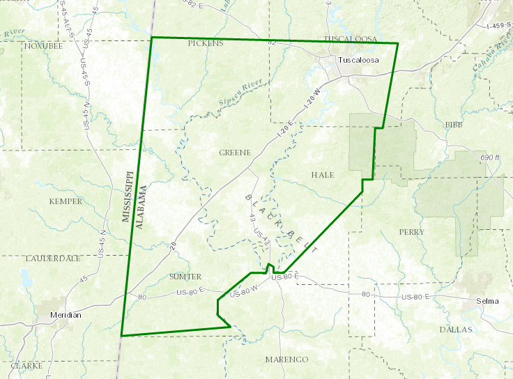
The National Weather Service in Birmingham has issued a Urban and Small Stream Flood Advisory for Poor Drainage Areas for Southwestern Tuscaloos, Southern Pickens, Greene, Hale, and Sumter counties until 5:30 PM CDT.
At 333 PM CDT, Doppler radar indicated heavy rain due to thunderstorms. This will cause urban and small stream flooding. Overflowing poor drainage areas will result in minor flooding in the advisory area. Excessive runoff from heavy rainfall will cause flooding of small creeks and streams, urban areas, highways, streets and underpasses as well as other drainage areas and low lying spots.
Some locations that will experience flooding include… Tuscaloosa, Northport, Livingston, Eutaw, York, Greensboro, Aliceville, Carrollton, Pickensville, Cuba, Holt, Moundville, Brookwood, Coaling, Coker, Forkland, Akron, Boligee, Union and Gainesville.
Category: Alabama's Weather, ALL POSTS
About the Author (Author Profile)
Scott Martin is an operational meteorologist, professional graphic artist, musician, husband, and father. Not only is Scott a member of the National Weather Association, but he is also the Central Alabama Chapter of the NWA president. Scott is also the co-founder of Racecast Weather, which provides forecasts for many racing series across the USA. He also supplies forecasts for the BassMaster Elite Series events including the BassMaster Classic.Subscribe
If you enjoyed this article, subscribe to receive more just like it.


