East Alabama Storms Still Packing a Punch
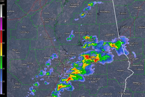
Storms continue this morning from Valley in Chambers County down I-85 past Auburn to Tuskegee and into eastern portions of the Montgomery Metro then on into northern Crenshaw County.
The NWS in Birmingham was just commenting on the hail signature sowing up on the Tallpoosa County storm that is near Lake Martin.
The storms aren’t severe, but they could produce hail and strong gusty winds as well as very heavy rain and deadly lightning. Pea sized hail was reported a short while ago in Opelika.
The rain is basically over northwest of a line from Cleburne through Clay, Coosa, Autauga and eastern Wilcox counties. The rest of the day will be mild and little breezy with highs in the 70s.
Still monitoring a severe weather threat for Sunday across Alabama. More details later today.
Category: Alabama's Weather, ALL POSTS
About the Author (Author Profile)
Bill Murray is the President of The Weather Factory. He is the site's official weather historian and a weekend forecaster. He also anchors the site's severe weather coverage. Bill Murray is the proud holder of National Weather Association Digital Seal #0001 @wxhistorianSubscribe
If you enjoyed this article, subscribe to receive more just like it.


