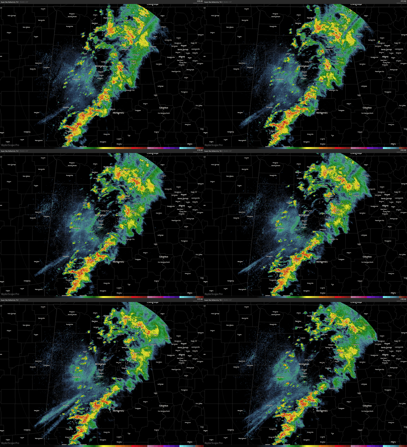
Heads Up Southeastern Counties In Central Alabama
RADAR CHECK
The line of showers and thunderstorms is currently stretching from Piedmont and Jacksonville, back to the southwest through Clanton and Selma, and through Citronelle and corssing over into the extreme southeastern part of Mississippi. Rain has mostly come to an end for the northwestern part of the area.
The atmosphere across much of Central Alabama has stabilized at this time, with only the southeastern parts of the area with any instability and shear where strong storms will be possible. Looks like now the main threats will be gusty winds and small hail. There may be a storm or two that may reach severe limits, but is becoming more unlikely as the morning progresses.
The only locations in the Central Alabama area that have the better risk for strong to severe storms will be the counties south of the I-20 corridor, and along and east of the I-65 corridor. Cities such as Montgomery, Alexander City, Auburn, Opelika, Troy, and Eufaula are still in the path of this line of storms. Once again, gusty winds and small hail will be the main threats. The tornado threat now is almost not worth mentioning at this point, but a brief spin-up could be possible if a storm happens to reach severe limits.
The National Weather Service in Birmingham is planning on allowing the Severe Thunderstorm Watch to expire at 5AM, as storm activity is expected to stay below severe limits.
Category: ALL POSTS


