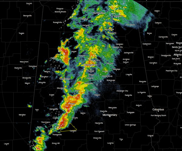
3AM Update On Our Weather Situation
Showers and storms continue to move across the state at this time, but the air mass over the northern parts of the state is more stable and keeping the risk for strong to severe storms rather low.
At this point, the better chance for strong to severe storms will be along and south of I-20 from the line of storms and to the east. There is a sweet spot where shear and instability values are the greatest over the counties of Bibb, Chilton, Perry, Dallas, Autauga, Lowndes, Coosa, Elmore, and Montgomery. These conditions should last for just a few more hours, and then the line is expected to weaken to a point where the risk for any strong to severe storms will be marginal at best.
There are no warnings currently in effect for any North/Central Alabama locations, and let’s cross our fingers that this trend continues. There is only one Severe Thunderstorm Warning in the state, and that is for a portion of Wilcox County, in the NWS Mobile CWA. Keep checking back with us on the blog for the latest information.
Category: ALL POSTS


