The Palm Sunday Outbreak: A Game Changer
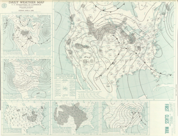
On the morning of April 11, 1965, warm, humid air was flowing northeastward into the Midwest ahead of a fast moving low pressure center that was dropping southeast out of Minnesota toward Iowa. A warm front was moving northward across Illinois and Indiana. Strong warm advection was occurring across the region in the wake of the warm front with temperatures in the lower 80s in some places. A strong cold front trailed southward from the low. In the upper levels of the atmosphere, a huge, positively tilted trough extended from an upper low center over the upper Midwest back to southern California. A strong jet stream was flowing over the Midwest with a 185 mph jetmax located on the morning sounding at Dodge City, Kansas. The Weather Bureau’s Severe Local Storms Unit (SELS) at Kansas City issued five tornado forecasts that day. Every tornado but two occurred in a forecast area.

Image: NOAA Central Library Data Imaging Project
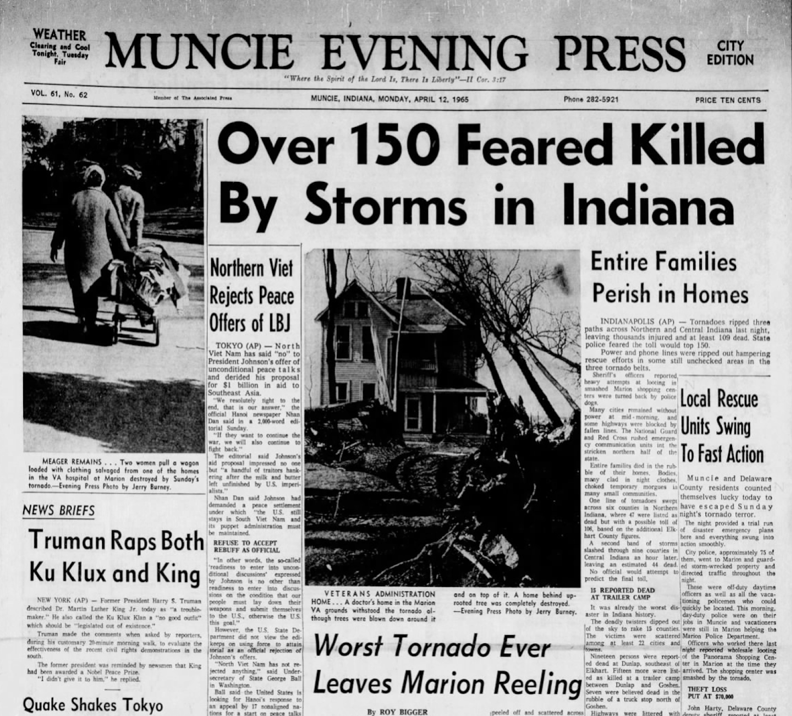
The first tornado touched down in Iowa just before 1 p.m. The Weather Bureau in Waterloo had no radar. A radio station in Cedar Rapids spotted the developing storm on their own aviation radar and alerted the Weather Bureau forecaster. The next twelve hours would be horrible. When everything was over, there were 47 tornadoes across seven states, including Iowa, Wisconsin, Illinois, Indiana, Michigan and Ohio. There were 21 killer tornadoes. Seventeen of the tornadoes were violent (F3 or greater.) A total of 260 people were killed and 3,442 injured. It was the most significant tornado outbreak since March 18, 1925 when the Tri-State Tornado occurred. It is the third deadliest tornado outbreak on record behind the Tri-State outbreak and the April 3, 1974 Superoutbreak. In Illinois, Crystal Lake was hard hit, with five fatalities from an F4. A massive F4 killed ten people at Koontz Lake, Indiana.

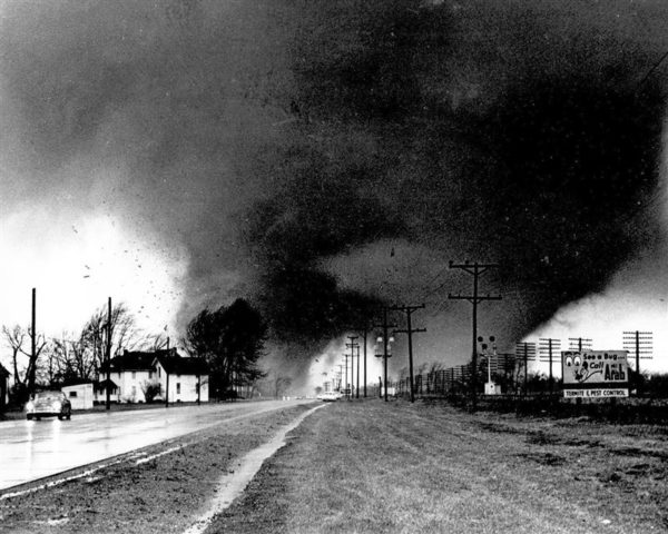
Image: Paul Huffman AP Elkhart Truth (NWS Syracuse, Indiana)
A terrifying series of pictures was snapped near Goshen, Indiana as a pair of massive funnels roared by. The towns of Russiaville and Alto were destroyed, with dozens of fatalities. At one point, blanket warnings had to be employed, covering up to nine counties at a time, as forecasters struggled to keep up with the fast breaking storms. Indiana was the hardest hit state, with 138 fatalities. As some of the powerful tornadoes moved from Indiana into Michigan, warnings could not be telephoned ahead because the phone networks were out. A total of 53 people died in Michigan. In Ohio, 60 people died from violent tornadoes during the late evening. Toledo was hard hit.
The Palm Sunday outbreak led to significant improvements in the warning system. But why? There were good forecasts. The dangerous storms were identified in plenty of time. The warning system had failed. People interviewed after the storm did not understand what a tornado “forecast” was. They didn’t understand the difference between “forecasts” and “warnings.” The next year, tornado forecasts would be named “watches.” One problem was that radar coverage was woefully inadequate across the outbreak area and there was poor communication between the Weather Bureau and media sources. Tornado forecast areas were defined as circles, triangles, and other kinds of shapes. The outbreak would lead a trend toward parallelogram tornado watches. They would begin in 1970. After the outbreak, the Weather Bureau started holding preparedness meetings as well as spotter talks and training. The goal became to saturate the public with information on tornadoes. NOAA Weather Radio would be another legacy of the outbreak.
Category: ALL POSTS, Met 101/Weather History


