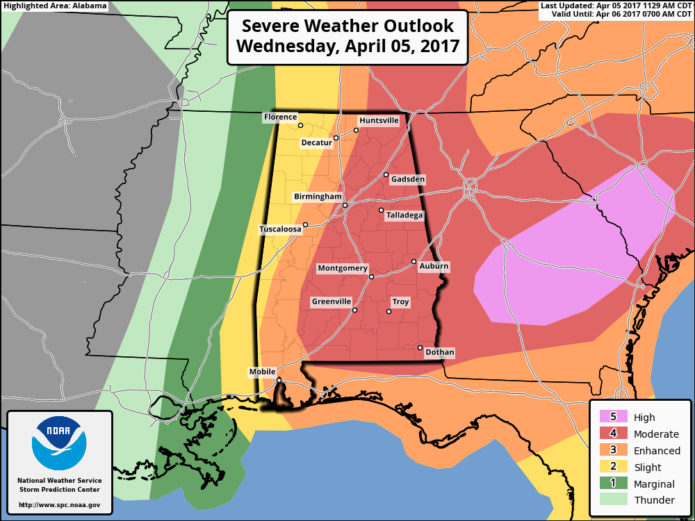
Latest Update From The Storm Prediction Center
The Storm Prediction Center has held with a moderate risk for a little over the eastern half of the state, while upgrading parts of south-central Georgia up into southeastern South Carolina to a high risk for severe storms. Thinking is that an outbreak of severe thunderstorms will be expected for portions of central and southern Georgia into South Carolina, and also for parts of eastern Alabama into south-central Kentucky. Very large hail up to baseball-size, along with damaging winds in excess of 60 MPH will be possible as well.
No new Tornado Watch for Central Alabama counties at this point, and NWS Birmingham will allow the current tornado watch expire at 12PM. A new watch will likely be issued later this afternoon as the cold front/dry line moves into the area from Mississippi.
Category: ALL POSTS


