Latest Thoughts For Later This Afternoon
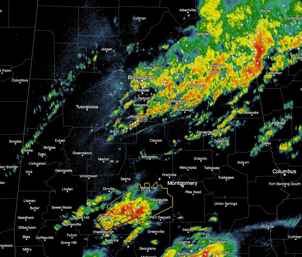
At this point, we are starting to transition our focus from the first wave of storms along and north of the warm front, to the cells that are developing to the south. Storms moving out of Clarke and Monroe counties and into Wilcox County, along with storms moving into Covington County from Escambia and Conecuh counties, will be a threat to the cities of Selma, Montgomery, and Troy through the next couple hours.
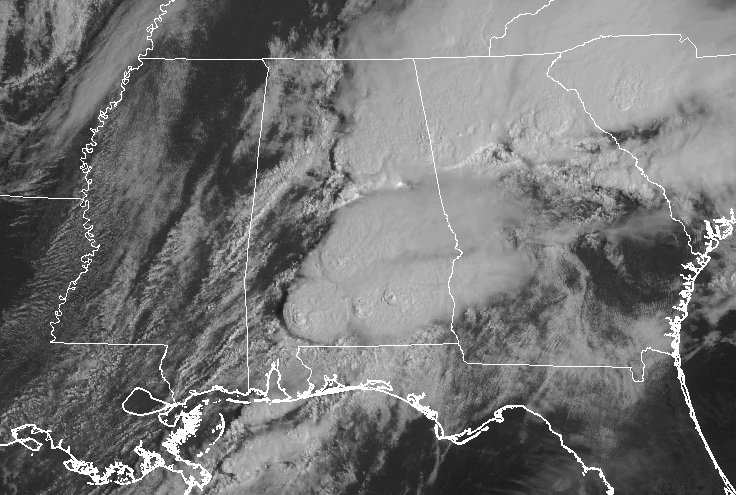
We have some breaks in the clouds from Washington County northward to Tuscaloosa County, and the heating from the sunshine will help raise temperatures, and will help destabilize the atmosphere even more through the rest of the morning hours across the western and southwestern parts of Central Alabama.
The environment remains supportive for severe thunderstorm development and for tornadoes south of the warm front, as bulk shear will be up to 55 knots and helicity values of 108 m2/s2.
Here are thoughts for later this afternoon…
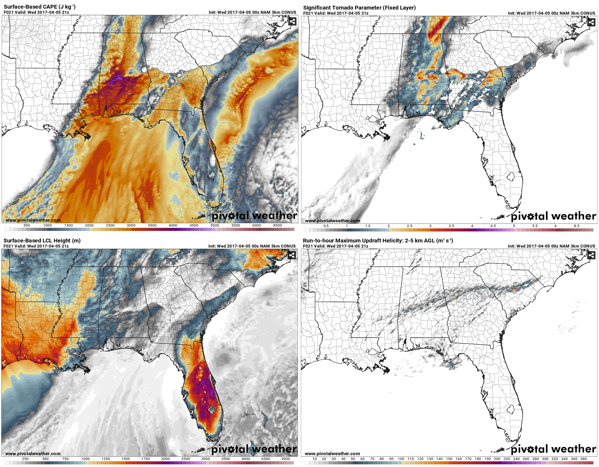
••• CAPE values will be running in the 3000-4000 J/kg or more at 4PM this afternoon.
••• Lifted Condensation Levels will be running from 200 down to below 50 meters.
••• Significant Tornado Parameter values will be in the 2-3 range for much of the area, with 4s and 5s close to the Georgia state line.
••• Updraft Helicity values are highest along a path from Sumter and Choctaw counties, to the northeast through Perry, Bibb, and Chilton counties, and continuing through Talladega, Clay, Cleburne, and Randolph counties.
••• Helicity values will be in the 150-250m2/s2 for much of the eastern half of the state.
••• Bulk shear will be in 50-60 kts range.
Temperatures will be running in the mid to upper 70s across much of the area, and dewpoints will be in the lower 70s. Even though helicity values are not overly impressive, the amount of instability that will be in place will overcome that and storms will be allowed to rotate. All of the ingredients are in place for strong/violent, long-track tornadoes, along with damaging hail up to the size of baseballs, and wind gusts in excess of 60 MPH.
Once again, all of the ingredients in place to where this will be a really active weather day. Be sure to have your smartphone charged and fresh batteries in your flash lights, radios, and your NOAA Weather Radio. Know where your safe place is in your home, and be sure everyone know where it is. Already have helmets and hard sole shoes in there for everyone, and have a portable air horn in case you need help.
Category: ALL POSTS


