The First Look at the SPC Day One Outlook
The new Storm Prediction Center severe weather outlook for Wednesday has been posted. It goes into effect at 7 a.m. CDT.
As we thought might happen, there is still enough uncertainty about the event that the folks at SPC stayed with a moderate risk for severe weather as the highest category for today. That could change later if conditions warrant an upgrade (or downgrade).
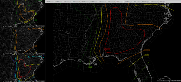
But for now, much of the state of Alabamais shown in a Moderate Risk, which means widespread severe storms likely. Much of the rest of the area has an Enhanced Risk, which means numerous severe storms likely. The remainder has a Slight Risk, meaning scattered severe storms are possible.
Here is the categorical risk on the right with the tornado, wind and hail probabilities shown on the smaller inset graphics on the left side.

The probabilities indicate the chance of a tornado, 58 mph or greater winds or 1 inch or larger hail within 25 miles of the points in that area.
The hatched areas indicate EF2 or greater tornadoes, 75 mph or greater winds and 2″ or larger hail.
The greatest threat of significant tornadoes will be over areas north and east of Birmingham and centered around the Auburn area. The entire area has a damaging wind threat and there is a threat of very large hail (2″ or greater) for areas generally along and east of I-65.
Category: Severe Weather


