Radar Check and Update at 845 p.m. Tonight
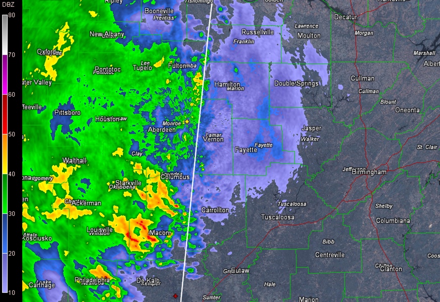
Rain and thunderstorms are spreading across eastern Mississippi and are entering West Alabama’s Lamar and Marion Counties at 8:45 p.m.

The storms are not severe at this time and no watches are in effect.
The activity is the leading edge of a large are of rain and storms that covers much of the state of Mississippi at this hour. Severe storms are in the Jackson MS area and over southern Mississippi as well.
This activity is expected to push into western Alabama later this evening and increase in coverage and intensity through the overnight hours as moisture increases rapidly across the state. Atmospheric profiles are expected to become more favorable overnight for severe weather as steep mid level lapse rates increase across the area and a strong low level jet swings eastward across Mississippi.
Tornado watches continue for much of Central and Southern Mississippi, much of Louisiana and extreme eastern Texas. A new tornado watch was just issued for Southwest Louisiana.
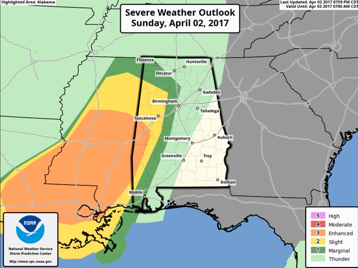
The SPC has parts of western Alabama from Marion and Walker Counties southward through Lamar, Fayette, Tuscaloosa, Pickens, Greene and Hale Counties in a slight risk area overnight with an enhanced risk from Sumter down through Choctaw and Washington Counties.
Here is the day one risk through 7 a.m. tomorrow morning:

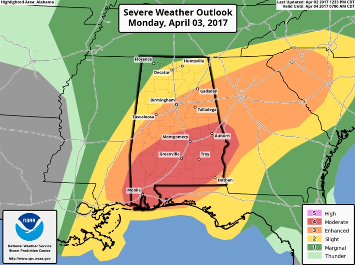
These risks expand eastward during the day on Monday and there is even a moderate risk for areas south of a line from Linden to Clanton to Lafayette. Widespread severe thunderstorms are expected in this area. Here is the day two risk starting at 7 a.m. tomorrow:

We will have frequent updates throughout the night and tomorrow.
Category: Alabama's Weather, ALL POSTS


