A Quick Look At Our Weather At Midday; Strong Storms Tormorrow
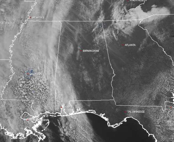
Skies across the area at the midday hour are mostly clear for a good part of the area, with a little more cloud cover along the Alabama/Mississippi state line and down into southwest Alabama. No rain on the radar at this point as well, but as you have been hearing for the past 5 days, that will not be the case for tomorrow. At this moment (12:19 PM), temperatures are currently in the mid 60s to the mid 70s across North/Central Alabama. The warm spot is currently Eufaula at 74 degrees, while the cool spot is Fort Payne at 64 degrees.
For the rest of the afternoon, skies will become mostly cloudy, as the clouds that are over Mississippi will move into the state ahead of surface low and trailing cold front. It will be quite breezy at times as well, with winds out of the south to southeast at 10-15 MPH. Afternoon highs will make it into the low to mid 70s for the northern half of Central Alabama, with mid to upper 70s for the southern half. I believe we all should be dry through the evening hours tonight, but the latest run of the HRRR model is showing a few spotty showers may develop over the western parts of the area. Overnight lows will be in the mid 50s to the lower 60s across North/Central Alabama.
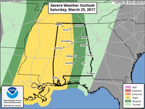
Tomorrow will be a pretty active day, as a surface low will be making its way near St. Louis, making Alabama have a moist and unstable air mass. The SPC continues to have the western half of the state in the slight risk for severe storms, with a marginal risk to the east. Looking at the latest model runs, we could have a few showers and thunderstorms develop for the morning, but the main threat for severe storms still appears to be from noon until 9:00 PM Saturday night. Now it will not rain all day tomorrow, but any storms that do pass through the area could be strong.
Main threat still appears to be from damaging straight-line thunderstorm winds, as well as the threat for some large hail. The highest shear values will be displaced from the higher instability values, keeping the tornado threat very low, but not zero. Rainfall totals should be in the neighborhood of 1/2 to 1 inch across the area, so flooding should not be an issue. Afternoon highs will be in the 70s across the area.
Just a brief look ahead into the upcoming week, we may actually have two more shots at strong to severe storms. The first as of now appears to be on Monday, as CAPE values are expected to reach 1000-2000 J/kg with steep lapse rates. Good news is that low-level shear rates are marginal so the tornado threat looks low, but damaging straight-line winds and hail will be possible with this system.
The next system will move across the state on Thursday, but it is too early to be specific on exactly what to expect at this point. This is just a great reminder that we are in the active point of our spring severe weather season, so these kind of events are pretty common for this time of the year.
Click here to see the Beach Forecast Center page. Save Up To 25% on Spring Break Beach Vacations on the Alabama Gulf Coast with Brett/Robinson! The Beach Forecast is partially underwritten by the support of Brett/Robinson Vacation Rentals in Gulf Shores and Orange Beach. Click here to see Brett/Robinson’s best beach offers now!.
Don’t forget you can listen to our weekly 90 minute netcast anytime on the web, or on iTunes. This is the show all about weather featuring many familiar voices, including meteorologists at ABC 33/40. We will produce this week’s show Monday evening at 8:30 CDT… you can watch it live here.
Category: Alabama's Weather, ALL POSTS


