A Brief Look At Central Alabama’s Weather Situation At 7:15 PM
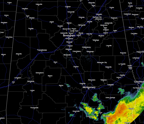
Currently across almost all of Central Alabama, rainfall has come to an end. The only place in the are receiving any rain at this moment are the extreme southeastern locations. Eufaula, Clayton, Louisville in Barbour County, along with Troy, Brundidge, and Banks in Pike County, are receiving some decent rainfall. There are a few scattered showers back to the west and northwest of these in south Alabama, but all of these should be exiting the area within the next 2 hours.
Temperatures at 7:13 PM are ranging throughout the 50s across Central Alabama. It’s currently 55ºF in Birmingham, 57ºF in Tuscaloosa, and 54ºF in Anniston. The cool spot is currently Cullman at 53ºF, while the warm spot is Eufaula at 58ºF.
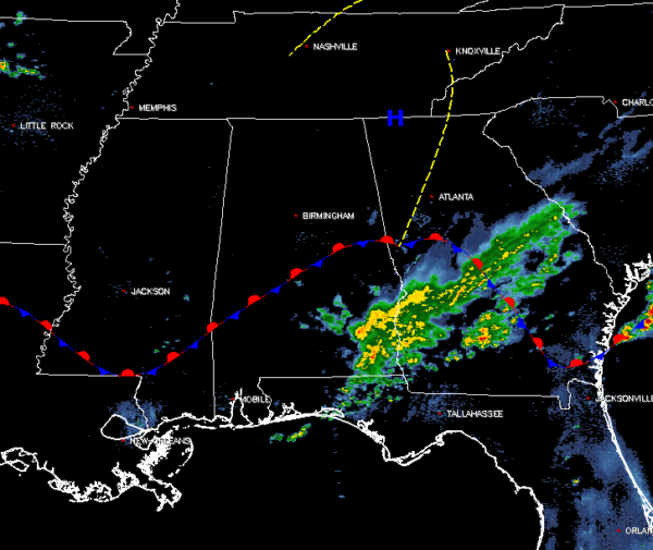
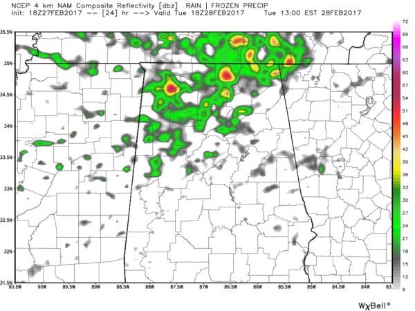
A stationary front continues to be draped over the southern portions of Central Alabama, but with a short wave trough passing to the north of the state during the night tonight and into the predawn hours on Tuesday, this will allow that stationary front to lift northward as a warm front across the area during the day and into the Tennessee Valley region of the state by the afternoon. There will be enough instability for scattered showers and thunderstorms to form, but there is no forcing nearby, and this will keep rain chances low for the southern 2/3rds of the area. The best chances for shower activity will be in the northern locations of Central Alabama, especially north of a line from Fayette to Jasper to Gadsden. Afternoon highs will be in the mid 70s to the lower 80s across the area.
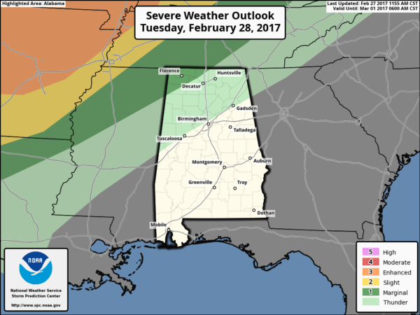
As you can see by the latest SPC outlook for tomorrow, there will be a chance of thunderstorms mainly for areas north of a line from Tuscaloosa to Birmingham to Gadsden, with a marginal risk for severe storms for the northwestern corner of the state.
Category: Alabama's Weather


