Cloudy Skies And Some Showers Moving Through Central Alabama At The Midday Hour
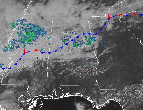
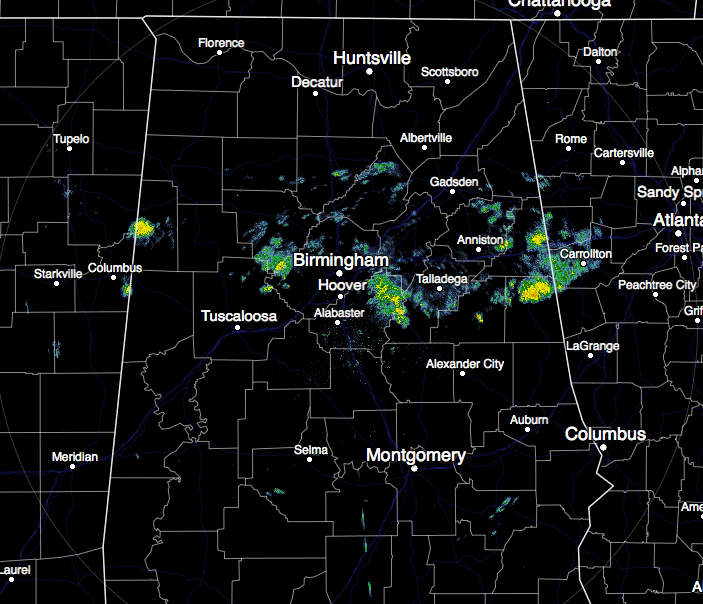
At the midday hour across Central Alabama, cloudy skies are overhead for most of the area with a broken band of light showers moving through the central parts of the area. Some of the locations in the southern parts of the area actually have sun shining at this moment. Those locations will have clouds move in later today.
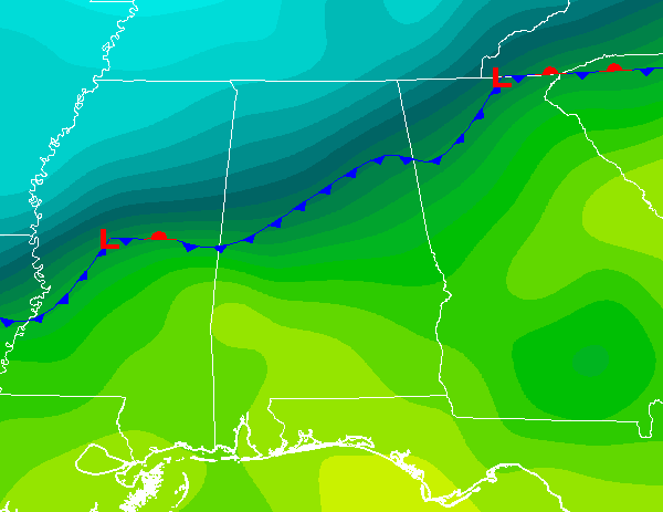
A cold front is currently draped across Central Alabama, and looking at the temperature gradient map of the southeast, you can clearly see where the cold front is.
Temperatures Across Central Alabama
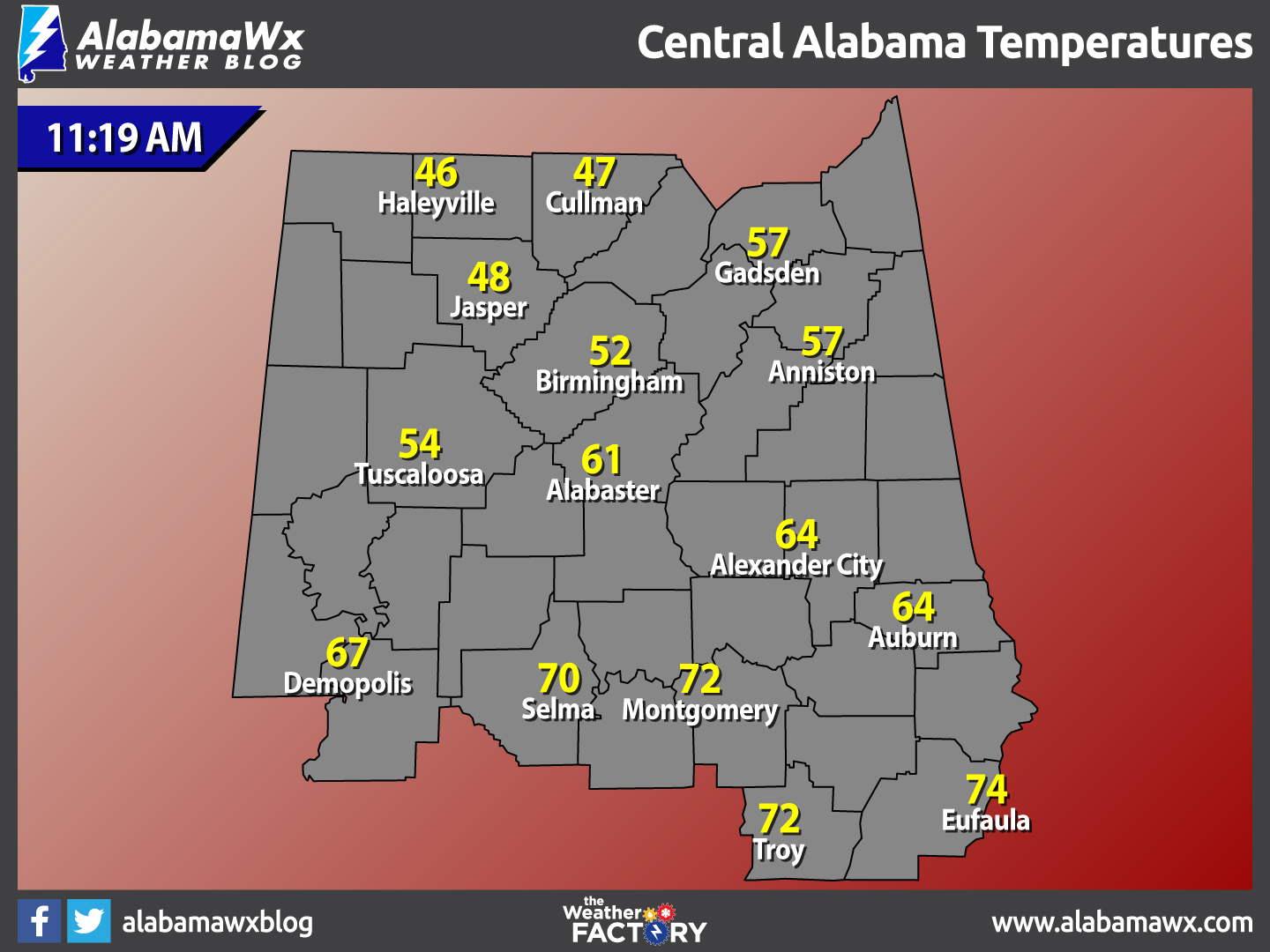
At 11:19 AM, the cold front is clearly making a big difference in temperatures across Central Alabama. Temperatures are currently running in the mid to upper 40s in the northern parts of the area, with lower 50s to lower 60s in the central parts, and mid 60s to the mid 70s for the southern parts of the area. The warm spot is currently Eufaula at 74 degrees, while the cool spot is Haleyville at 46 degrees.
Weather For The Rest Of Your Thursday
With a cold front over Central Alabama, scattered showers can be expected along and ahead of the front. As the front ever so slowly pushes to the south, so will the coverage of the showers. Otherwise, skies will be mostly cloudy to cloudy, and temperatures will be a mixed bag compared to where you are in comparison to the front. Afternoon highs will be in the upper 40s in the north to the mid 70s in the south. The Birmingham Metropolitan Area will top out in the mid 50s. For tonight, shower chances will continue, with the better chances for rain around and just south of the I-20 and I-20/59 corridors. Overnight lows will be in the upper 30s to the north, with lower 50 to the south.
Birmingham’s Climatology And Records
The normal high for February 2nd is 55, while the normal low is 33. The record high for today was set back in 1989 at 77 degrees. The record low was set back in 1951 at 7 degrees.
Groundhog’s Day
Birmingham Bill made his annual appearance at The Birmingham Zoo this morning, and was greeted with cloudy skies and rain falling. Therefore, his festivities were move indoors to the auditorium, and clearly giving us the answer of an early spring for the Magic City. A full post about the folklore of Groundhog’s Day, and what Punxutawney Phil saw up in his neck of the woods, can be found here.
The First Friday For February
The cold front is expected to be around the US-80 corridor tomorrow morning, and that will push the better chance of shower activity to the southern parts of the area. North of that, skies will be mostly cloudy, with a few peeks of sunshine breaking through possibly during the afternoon hours. Afternoon highs will be in the upper 40s to the lower 50s in the north, with mid 50s to mid 60s to the south.
National Extremes
The warmest high temperature set for the nation on Wednesday afternoon was 91 degrees, set in Cotulla, Texas. The coldest low temperature for Sunday night and into this morning was -19 degrees, set in Bozeman, Montana. The highest precipitation total for the 24 hour period starting at 11AM Wednesday to 11AM today was 0.79 inches at Adak Island, Alaska.
On This Day In Weather History: 1990
Thunderstorms developing ahead of a cold front produced severe weather in the Lower Mississippi Valley during the late afternoon and evening hours. One person was injured in a tornado near Reidheimer LA. Thunderstorms northeast of Brandon MS produced hail three inches in diameter along with high winds which downed or snapped off one hundred trees.
Follow The Blog On Social Media
Remember that you can also get the latest updates from the Alabama WX Weather Blog on social media. Follow us on Facebook and on Twitter.
WeatherBrains
To hear the latest of the weekly netcast that’s all about weather featuring many familiar voices, including our meteorologists at ABC 33/40, you can listen anytime on the web at Weatherbrains.com, or on iTunes.
Forecaster: Scott Martin (Twitter: @scottmartinwx)
Category: Alabama's Weather


