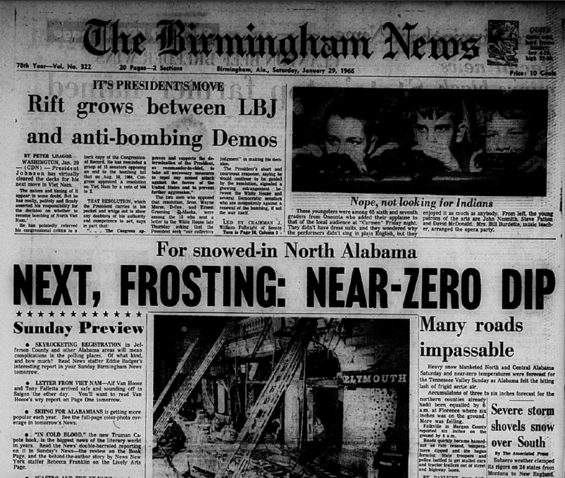
The Rest of the Story: Alabama’s Coldest Morning on this Date in 1966
Early on the morning of Friday, January 28, 1966, cold high pressure covered Alabama and the Deep South. The morning low at Birmingham was 22F. The low the previous morning had been 16F. The month had turned very cold after a warm start. The 70F reading on January 2nd was but a distant memory as lows had not gone above freezing since the 15th and daily temperatures consistently ran ten degrees or more below average for the latter half of the month.
Arctic high pressure was centered over Canada and was coming south. The Arctic front was knocking on the door of North Alabama on the morning of the 28th. But the stubborn high over the Southeast only allowed the front to make progress to about I-20 and that night, low pressure along the Texas coast began to move east.
Just before midnight on Friday night, a chilly rain began falling in Birmingham, where the temperature was 41F. At the same time, it was snowing heavily in Little Rock with 18 degrees and moderately in Nashville, where it was 16F. It was sleeting at Shreveport with a temperature of 28F.
The chilly rain gradually changed to sleet and then to heavy snow across North and Central Alabama on Saturday morning, fulfilling the predictions of weather forecasters. Snow piled up during the day on Saturday as temperatures plunged and northwesterly winds howled. Roads were icy north of Clanton.
Ten inches of snow was on the ground at Florence, with ten inches at Tupelo, MS. Other reports included:
…11 inches at Moulton
…8 inches at Hamilton, Scottsboro, Cullman and Red Bay
…7 inches at Guntersville, Double Springs and Russellville
…6 inches at Jasper, Falkville and Albertville.
There was 7.3 inches on the ground in Huntsville and 8 inches at New Market in Madison County. That snowcover would be critical to an important record that would fall early the next morning.
Skies cleared by afternoon, putting an end to the snow. The temperature didn’t stop falling until it registered a low of 2F at Birmingham just before midnight. The state’s all time cold reading before that morning was -18F at Valley Head, measured on February 14, 1905.
It was thought to be an unassailable record. But as the readings came in from observers that bitterly cold morning, the eyes popped out of the heads of Weather Bureau forecasters.
Readings included:
-17F in Haleyville
-12F at Redstone Arsenal
-11F in Muscle Shoals and Valley Head.
In the Birmingham area, it was -4F at the Airport, -5F in Pinson and -2F in Bessemer. But in the warmer spots, there was still a light breeze blowing, or it would have certainly been even colder. Places where the wind was calm, the mercury had been able to reach unthinkable levels.
The reading of -24F at Russellville in was reported in the news media as the coldest place in the United States that morning. How many times have you ever seen Alabama has the nation’s coldest reading?
But the observation from New Market would be misreported as -17F. It actually was -27F, a fact that would not come to light for several years. I will let Dr. John Christy, the Alabama State Climatologist, take over the story in his excellent piece on Alabama’s all time record cold, shown to the left. Now you know the rest of the story.
The cold reached all the way into Florida, where citrus crops were damaged. The Birmingham News warned that the price of orange would be going up.
In South Alabama, readings included:
…9F in Fairhope and Bay Minette
…13F in Mobile
…14F at Fort Morgan
…5F at Montgomery and Selma.
It was 0F as far south as Clanton.
Mississippi also recorded their state all time record low on this date with -19F at Corinth.
Category: Met 101/Weather History


