Warm January Weekend Ahead
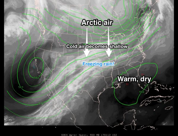
UPPER HIGH BUILDS: A strong ridge in the upper atmosphere will continue to build across the Southeast U.S. in coming days… producing warm afternoons for January, and keeping the cold and ice issues north of our region.
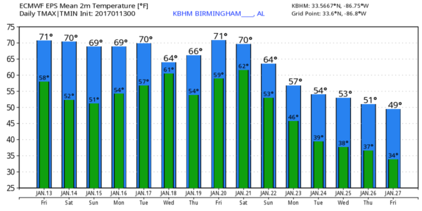
We will forecast a mix of sun and clouds today, tomorrow, and Sunday with afternoon highs in the 71-75 degree range, just under record levels for mid-January. Here are the record highs for Birmingham…
Today (January 13) 77 (1932)
January 14 78 (1932)
January 15 78 (1947)
January 16 77 (1943)
January 17 79 (1943)
January 18 76 (1929)
A far cry from the snow and ice issues we had a week ago; keep in mind it was as cold as 7 degrees in Alabama this past Saturday (January 7). This is a state where it never “gets cold and stays cold”. Examples…
Birmingham’s coldest temperature on record came on February 13, 1899 when the temperature dropped to 10 degrees below zero. But, only 8 days later on February 21, 1899 the high zoomed to 70 degrees.
In 1982, the low at Birmingham was -1F on January 11 with a crippling ice storm to follow in the days ahead. But, just 8 days later on January 19, the high was a balmy 76 degrees.
FYI…the warmest January temperature on record in Birmingham is 81 degrees… measured on January 10, 1949.
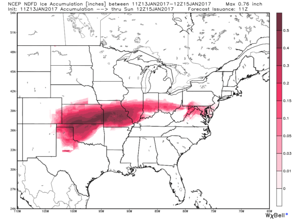
ICE ICE BABY: For travelers we should mention ice storm warnings are up for parts of Oklahoma, Kansas, Missouri, and Illinois as freezing rain in very cold air has potential to bring very significant ice accumulations.
NEXT WEEK: The ridge holds early in the week, and the weather looks mostly dry and warm Monday and Tuesday. The chance of showers and storms will increase by Wednesday and Thursday as the upper high weakens, and there seems to be some chance of strong storms by Thursday or Thursday night. Too early to know if severe storms will be an issue.
And, still signs of cold air returning to the Deep South toward the end of the month. See the Weather Xtreme video for maps, graphics, and more details.
WEATHER BRAINS: Don’t forget you can listen to our weekly 90 minute netcast anytime on the web, or on iTunes. This is the show all about weather featuring many familiar voices, including our meteorologists here at ABC 33/40.
CONNECT: You can find me on all of the major social networks…
Facebook
Twitter
Google Plus
Instagram
I have a weather program this morning at Vincent Elementary in Shelby County… look for the next Weather Xtreme video here by 4:00 this afternoon. Enjoy the day!
Category: Alabama's Weather


