Frigid Start to Your Sunday
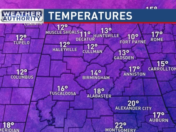
It is starting out very cold this morning with some of the coldest temperatures we’ve seen since early 2015! As I’m writing this the temperatures across North and Central Alabama ranged from 10 at Fort Payne to 18 at Calera (Shelby County Airport). And our Skywatcher at Black Creek has reported a low of 7 degrees! Looks like we could go above the freezing point this afternoon with lots of sunshine coming in from a clear sky. Highs today are expected to reach into the middle and upper 30s.
As you probably expect, the cold has a grip on much of the Nation so there are no areas of severe weather projected for the next few days.
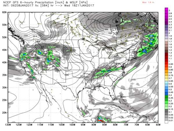
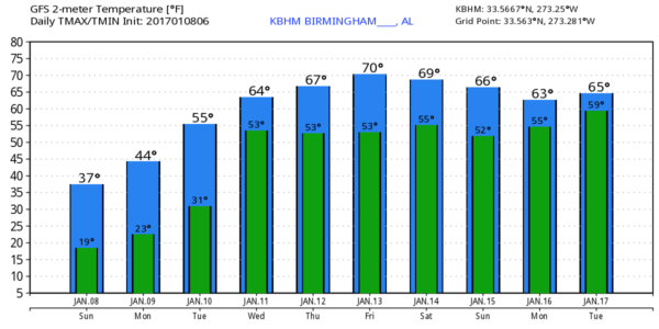
The surface high will migrate eastward into the Atlantic Monday and Tuesday. This will turn the surface flow around to the south in the Lower Mississippi River Valley on Monday and here late Monday and Tuesday. Daytime highs should climb to near 50 on Monday and into the 60s on Tuesday. Don’t you just love the rapid turn around we experience in the Southeast US? 14 degrees on Sunday morning and 60 by Tuesday afternoon!!
The upper air pattern shifts from a deep trough along the East Coast today to ridging Monday and Tuesday. But by Tuesday we’re watching a trough move quickly through the fast moving flow to our north resulting in a cold front that will be dragged into the Southeast US late Tuesday and Wednesday. Front loses it’s forward momentum as it becomes parallel to the upper air flow. This will provide us with the best chances for rain from late Tuesday into the first half of Wednesday. But those chances, while the best, are not expected to be particularly high with rain probability standing around 40 percent. Rainfall amounts will be lower than what was projected yesterday with places getting rain only receiving about a quarter of an inch at best.
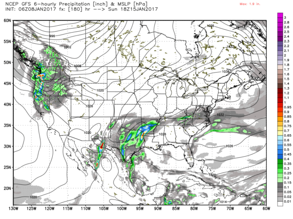
The upper air pattern is forecast to remain a ridge from an upper high centered over the Florida Peninsula for the latter half of the week ahead. Another front will drag southeastward Friday but it is not expected to actually reach the Southeast US as we were seeing yesterday. This run of the GFS is much more bullish on the upper ridge with the primary action to our west where a deep trough and closed low are forecast to dig into northwestern Mexico. This pattern is reminiscent of the one we saw the first couple of days of 2017 as that trough taps into Pacific moisture. The primary threat for a rainy pattern appears to be a little to our west over Texas, Arkansas, and Oklahoma for the 15th of January. That rain will finally come our way around the 17th as the deep trough ejects east-northeast across Texas. But this is verging several days into voodoo country, so you can expect to see changes to the forecast before we actually get to week 2.
As I mentioned yesterday, the pattern is expected to remain fairly fast. Once the trough ejects by us around the 18th, we’ll have a couple of mild days with another trough digging into Texas on the 21st of January. That one will move by us around the 22nd and turn the upper flow northwesterly again with another potential for some cold weather as we get to 372 hours into the forecast.
WORLD CLASS TENNIS RETURNS TO BIRMINGHAM: The BJCC will host the first-round tie against Switzerland February 3rd-5th. Single-day tickets are on sale now. Get them while they last! Buy tickets here.
James Spann returns with the warmer weather tomorrow morning. I hope that you have a great day. Godspeed.
-Brian-
Category: Alabama's Weather


