Evening Update
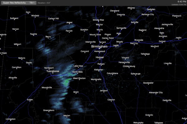
RADAR CHECK: We have some patches of light rain/sleet/snow over West Alabama already this evening, but temperatures there are well above freezing, and we expect no travel issues before midnight.
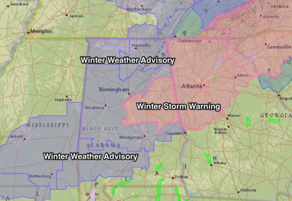
A winter storm warning goes into effect tomorrow morning for East-Central Alabama, with winter weather advisories for much of the rest of Alabama.
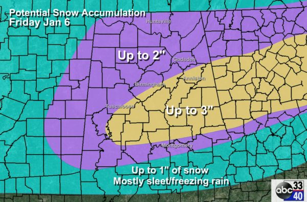
Heaviest snow, most likely, will come in the winter storm warning area…
EVENING NOTES:
*We could see a touch of bridge icing as early as 6:00 a.m. tomorrow over West Alabama due to light freezing rain, sleet, or snow. Precipitation will be generally light during the morning hours.
*Heavier precipitation, mostly snow for the northern half of the state, begins later in the day.
*Road continues will deteriorate tomorrow afternoon and tomorrow night, especially where heavier bands of snow and sleet set up. Temperatures will stay below freezing across much of North Alabama as very cold Arctic air is pulled southward.
*Tomorrow night will bring snow to North Alabama, and a wintry mix for the southern counties of the state, and as temperatures fall into the 20s icy travel is likely and travel will be discouraged almost statewide.
*Understand the “accumulation potential” maps we show are just a guideline, and “up to 3 inches” means a range of zero to 3. Not everybody will get accumulating snow in these colored bands; we prepare these maps simply as a guideline. Some will get 2-3 inches of snow, others will get nothing.
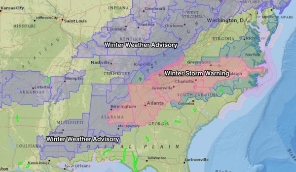
*If you are traveling, remember the snow will expand eastward Saturday into Georgia and the Carolinas.
*Operations at Birmingham-Shuttlesworth Airport could be impacted by winter weather tomorrow and tomorrow night, and Hartsfield Airport in Atlanta could see many delayed flights Saturday because of snow.
Stay tuned to the blog for updates..
Category: Alabama's Weather


