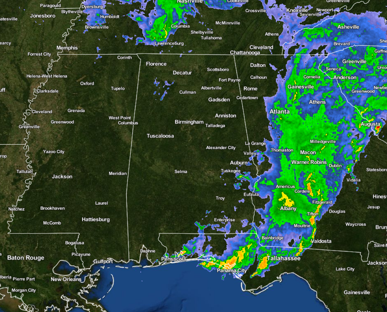
A Final Update On Central Alabama’s Weather For Today
Nearly all of the storms have pushed over into Georgia at this time, and the weather will be quiet for the overnight hours tonight and into tomorrow morning. Only a few pesky showers are left over down in the southeastern parts of the area near Auburn, Tuskegee, and Eufaula. A few more showers are located in Marion and Winston counties. The isolated cells are moving to the northeast, the the showers as a group are moving slowly to the east.
After a strong storm system with multiple waves moved through Central Alabama during the day, only one storm was able to start rotating enough to produce a tornado. A possible tornado touched down in Northeastern Pike County and traveled into Western Bullock County before weakening and lifting. A storm survey team from NWS Birmingham is expected to examine the damage during the day on Tuesday.
We do have some sad news to report with tonight’s storms. Four people lost their lives from a possible tornado in a single structure in the Rehobeth area of Houston County. Our thoughts and prayers go out to the families involved.
Rain reports from around the state show an impressive amount of rain fell mostly in the southern 2/3rds of the state, with lesser amounts to the north. Here is a list of rain amounts as of 6:00 PM.
- Anniston 2.10 in
- Auburn 2.95 in
- Birmingham Intl 1.43 in
- Brookley Field 4.44 in
- Calera 2.12 in
- Decatur 0.33 in
- Dothan 1.04 in
- Evergreen 3.11 in
- Huntsville 0.27 in
- Mobile 3.59 in
- Montgomery 3.83 in
- Muscle Shoals 0.73 in
- Troy 5.08 in
- Tuscaloosa 2.88 in
Rain totals will surely be higher when the official tally come in to the NWS later tonight. We’ll have those totals for you tomorrow on the blog. Most of these totals will make a nice dent into our drought deficits.
Category: Alabama's Weather, Severe Weather


