Front Pushing Southeast; Rain Area has Stalled Temporarily
A quick update before Brian posts his video.
The cold front now extends from near Anniston to Sylacauga to Selma to Coffeeville in Clarke County.
The intensity of the radar echoes has diminished along the leading line. There hasn’t been any lightning in a while.
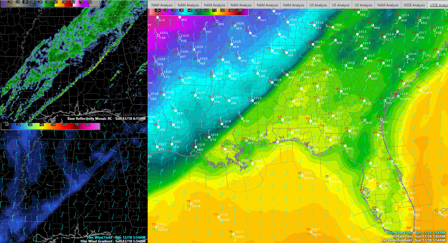
Temperatures are dropping behind the cold front. The temperature is now down to 49F at the Birmingham Airport and 45F at Tuscaloosa. It is now 35F at Muscle Shoals and 34F at Haleyville.
Some freezing rain is occurring over Northwest Alabama.
The area of rain has stalled in east eastward progress as the front becomes parallel to the upper level flow. This is bad news for areas that need the beneficial rains that it promised for the exceptional drought areas of Central Alabama.
It will be a miserable, cold and wet day for areas north of I-59 with temperatures in the 30s.
The rain will eventually work its way southeastward but it will be weakening slowly, so rainfall amounts will be barely moderate, around one half inch in the I-59 Corridor and points southeast. Temperatures will fall back into the 30s through the morning hours in areas along and southeast of I-59.
Category: Alabama's Weather
About the Author (Author Profile)
Bill Murray is the President of The Weather Factory. He is the site's official weather historian and a weekend forecaster. He also anchors the site's severe weather coverage. Bill Murray is the proud holder of National Weather Association Digital Seal #0001 @wxhistorianSubscribe
If you enjoyed this article, subscribe to receive more just like it.


