Update On The Central Alabama Weather At The 10AM Hour
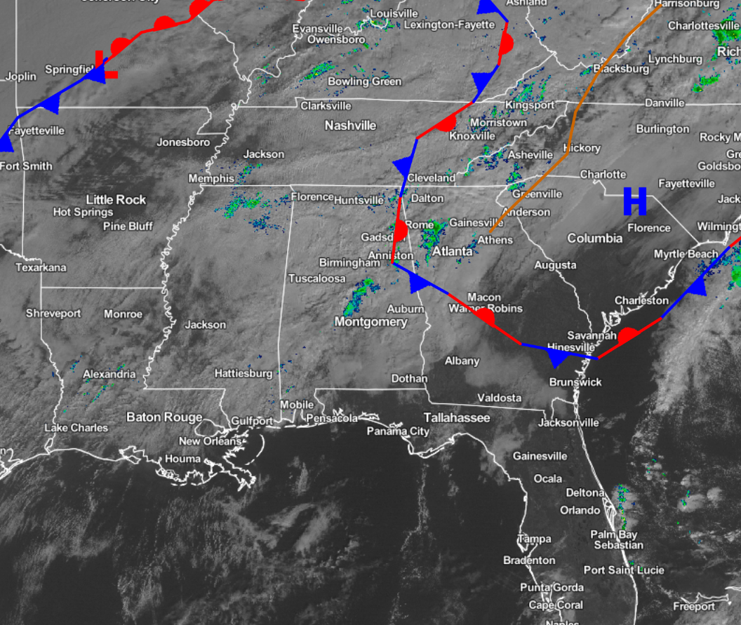
Conditions across the Central Alabama area at this time remain pretty quiet at this hour, as cloud cover is keeping the area free of any sunshine at this time. We do have a few scattered showers out there at this time over extreme northeastern Dallas County to western Autauga to central Chilton to northwestern Coosa to southern Talladega county. A few more showers are scattered across western Cleburne, eastern Etowah, northern Calhoun, and western Cherokee counties. These are pushing off to the east-northeast. As far as the cold front that will be pushing into the area during the overnight and early morning hours on Sunday, it is currently stretching back to the southwest from the low in southern Missouri through southeastern Oklahoma and back into northern Texas. Currently there are no convective watches or warnings issued for anyone at this point, and really the entire southeastern United States is pretty quiet other than a few showers here and there.
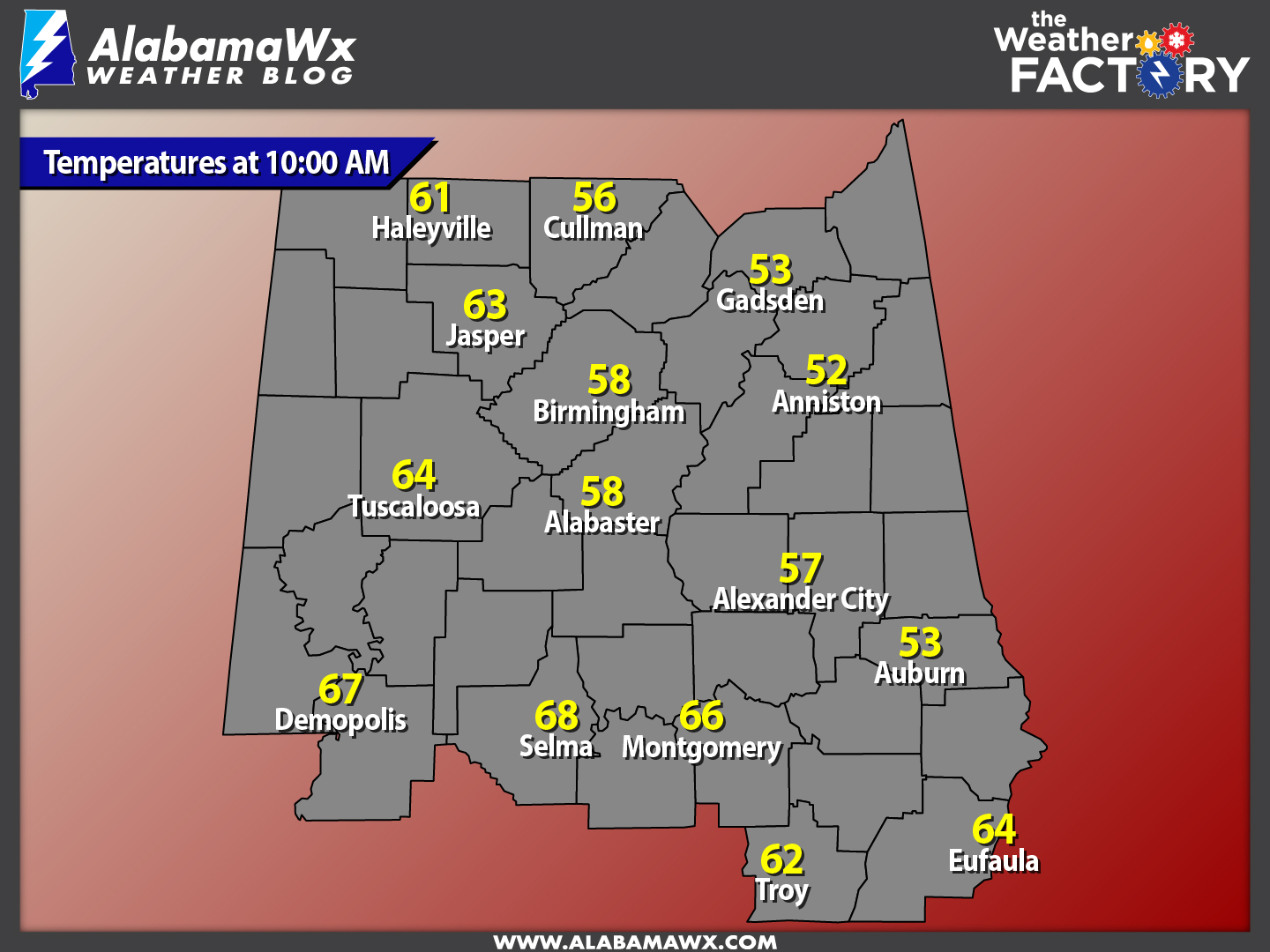
Temperatures at this time across the area are in the upper 50s to the upper 60s across the area, and they are only expected to climb even more today, as more warm air will be advected ahead of the approaching cold front. The warm spot is currently Selma at 68 degrees, with the cool spot located at Anniston at 52 degrees.
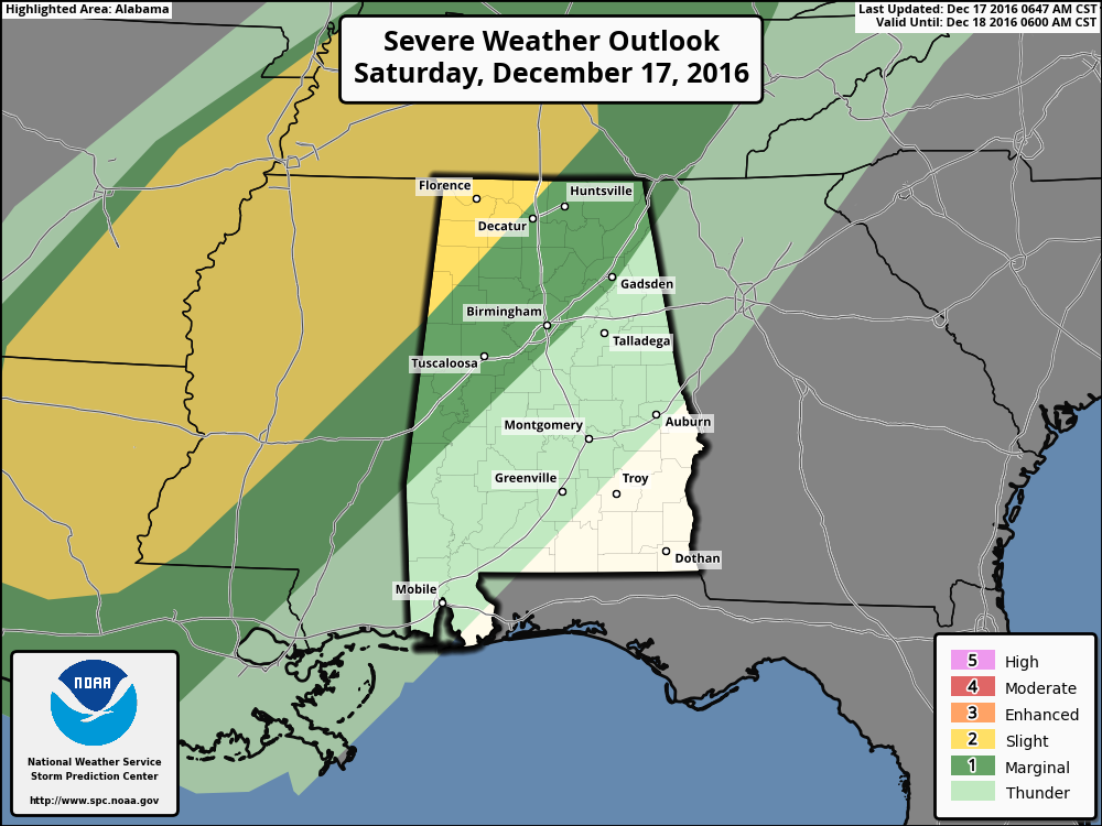
The Storm Prediction Center is still holding to the graphic from earlier this morning, showing the northwest corner of the state in the “Slight Risk” for severe storms during the remainder of the day today and up to 6AM tomorrow morning. The timing on the threat for severe weather for the area still appears to be from midnight tonight through 4AM tomorrow morning, with the main threat being from damaging straight-line winds and a few isolated tornadoes.
We will have frequent updates on the blog. Watch for new posts throughout the weekend.
Category: Alabama's Weather, Severe Weather
About the Author (Author Profile)
Scott Martin is an operational meteorologist, professional graphic artist, musician, husband, and father. Not only is Scott a member of the National Weather Association, but he is also the Central Alabama Chapter of the NWA president. Scott is also the co-founder of Racecast Weather, which provides forecasts for many racing series across the USA. He also supplies forecasts for the BassMaster Elite Series events including the BassMaster Classic.Subscribe
If you enjoyed this article, subscribe to receive more just like it.


