New Tornado Watch to the South and Southeast; First Damage Survey Info
Rain is about to end in the Birmingham metro area, but not before leaving 1.74 inches at my house in Vestavia for a three day total of 3.40 inches. Thank you!
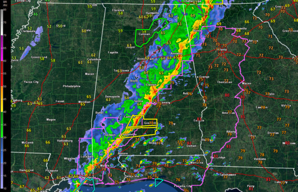
The tornado watch was allowed to expire at 10 a.m. and was not reissued for western Alabama. A new tornado watch was just issued for Barbour, Bullock, Chambers, Elmore, Lee, Lowndes, Macon, Montgomery, Pike, Randolph, Russell and Tallapoosa Counties till 5:00 PM CST.
There are warnings ahead of the line in South Alabama, for parts of Wilcox, Monroe, Butler and Conecuh Counties. There is a slight risk severe weather outlook for areas east of a line from Centre to Clanton to Grove Hill, but that will shoved eastward along with the storms all day. Storms could become severe ahead of the line as the airmass destabilizes with daytime heating over southeastern portions of the area.
National Weather Service survey teams from Birmingham and Huntsville are going over the damage from last nights storms. In the Tennessee Valley, three people died and four children were critically injured in the Rosalie area of Jackson county by an apparent tornado. The same tornado damaged 60 structures in the Ider community in DeKalb County, with possibly 25 destroyed. There were approximately injuries with 10 individuals still hospitalized.
Birmingham Survey Team 1 has confirmed a tornado in Pickens County north of US 82 on CR 35. No determination on length/width, but so far it is at EF1 strength.
Birmingham Survey Team 2 has confirmed tornado damage in Winston County in the Arley area and towards the Helicon FD. So far that looks like EF1 damage.
Category: Alabama's Weather, Severe Weather


