Latest Update & Mesoscale Discussion
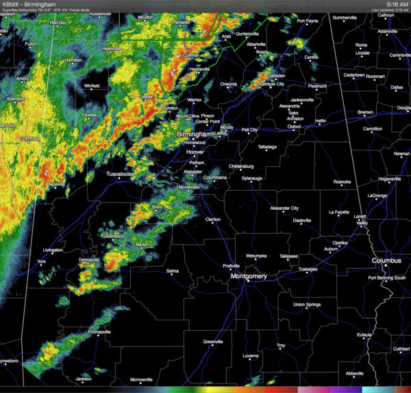
The part of the squall line that is in the state is currently located stretching from Scottsboro back to the southwest to Pickensville. No convective warnings are in effect for anyone in Central Alabama at this moment. A few counties in the northern part of the state, including Cullman County, are currently under Flash Flood Warnings. The line is slowly pushing to the east, as the cells in the line are moving to the northeast.
The threat for damaging wind gusts and a tornado or two persists across the watch area. Thermodynamic environment ahead of the convective line has changed little over the past hour or so, with the majority of the watch area still characterized by temperatures in the low 70s and dewpoints in the mid 60s. These conditions in tandem with generally moist profiles remain supportive of modest instability and the latest data suggests MLCAPE around 500 j/kg. Kinematic environment has also remained relatively unchanged with only a slight increase in the vertical shear. Subtle backing has occurred at Tuscaloosa and at the Shelby County Airport in Central Alabama as the convection within the pre-frontal confluence moves into the region. There has also been a slight uptick in updraft strength and increased eastward motion with the portion of the line near Jasper. All this to say, the severe threat persists across the region with mesoscale influences playing a large role in modulating storm strength. Damaging wind gusts and a tornado or two remain possible.
Category: Alabama's Weather, Severe Weather


