Blue Skies and Cool Temperatures at Midday
A COOL BUT SUNNY MIDDAY ACROSS CENTRAL ALABAMA
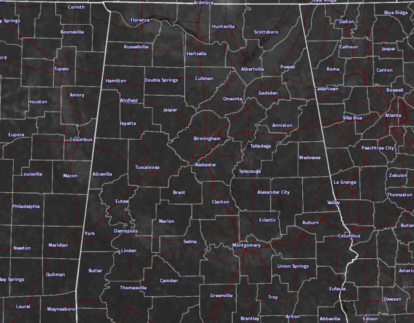
As you can see for the latest visible satellite image for Central Alabama, sunshine is out in full force, and not a single cloud can be found on this image. And of course with no clouds, there is no rain, and we badly need the rain. Even though many places in the area saw little rain on last Saturday morning, those numbers won’t even put a scratch into the deficits that we have. Birmingham is 11.43 inches in the hole for the year in rainfall, with Tuscaloosa short by 13.69 inches, and Anniston by a whopping 17.28 inches.
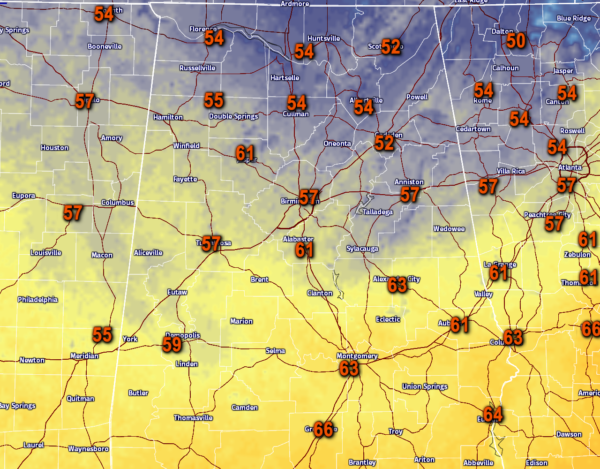
Temperatures at 12PM across Central Alabama are mostly in the 50s and 60s. The warm spots in the area are Alexander City and Montgomery both at 63 degrees, with the cool spot being Gadsden at 52 degrees.
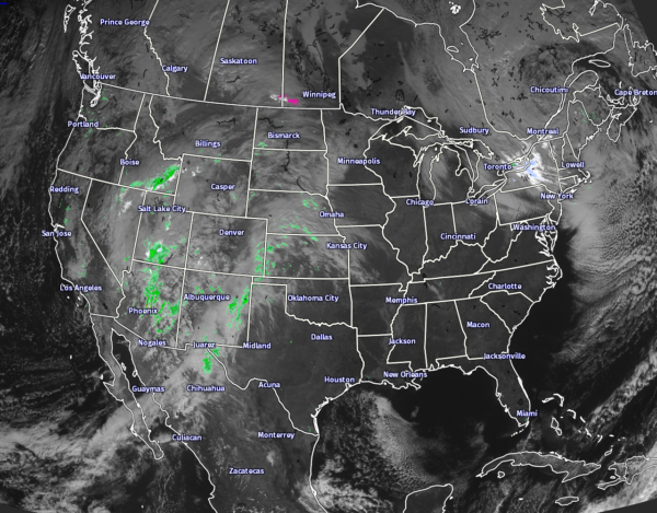
Looking at the Sat/Rad image for the lower 48, the closest rainfall is currently falling over the nation’s mid-section and back down in to eastern parts of New Mexico. Lake-effect snow is the story across parts of Central New York. Hopefully, we can have some moisture head our way with a front that will be moving through on Wednesday.
BIRMINGHAM’S CLIMATOLOGY AND RECORDS
The normal high for November 21st is 63, while the normal low is 40. The record high for today was set back in 1900 at 81. The record low was set back in 1937 at 22.
LATEST DATA FROM THE U.S. DROUGHT MONITOR
The latest data from the U.S. Drought Monitor for the state of Alabama now shows that over 65% of the state is now classified under “extreme” or “exceptional” drought conditions. That is an increase of over 13% from last week. A Drought Emergency continues in effect, banning any outdoor burning for all counties in the state. Click here for more information. Be sure to conserve water as well, as the Birmingham Water Works remains in a “Stage 4 Drought Emergency.”
FOR THE REST OF YOUR MONDAY
The sun will be out in full force for the remainder of the afternoon, and highs will be in the 60 to 65 degree range across the Central Alabama area. Winds will be around 5 MPH or less out of the north. Clear skies and cold temperatures once again for this evening and into the overnight hours. Lows will drop down into the 20 to 32 degree range across the area, with some of the colder spots dropping into the upper teens once again.
WHAT TO EXPECT FOR TUESDAY
It will be another day featuring a cold start, but warming very nicely under sunny skies. Afternoon highs will be in the 66 to 72 degree range across the area. A few clouds will start to roll in over the northwestern parts of Central Alabama during the evening, and skies will become partly to mostly clear. Overnight lows will be quite warmer, only dropping into the 35 to 40 degree range for the eastern half of the area, and in the 41 to 46 degree range in the western half.
FOR THOSE WHO ARE BEACHBOUND
Maximum sunshine for today and Tuesday on the coast from Ft. Morgan to Panama City Beach, with highs in the 60s and lows in the 30s. Mostly cloudy skies and a few showers are possible on your Wednesday, before mostly sunny skies return for the rest of the week. Highs will be in the 70s with lows mostly in the 50s. See a very detailed Gulf Coast forecast here.
UPDATE ON THE TROPICS
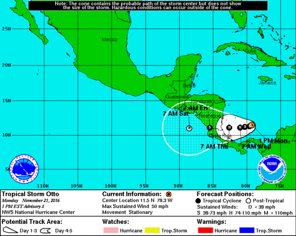
The broad low that was located over the Southwestern Caribbean Sea has strengthened into a tropical depression earlier this morning, and as of the 12PM update, has not become Tropical Storm Otto. Maximum sustained winds are currently at 50 MPH, and movement is stationary. The NHS has Otto strengthening into a hurricane within the next 48 hours as it starts to move westward. Landfall is expected somewhere along the Gulf Coasts of Nicaragua and Costa Rica sometime on Thursday, before weakening back into a depression and emerging into the Pacific Ocean sometime on late Friday.
ON THIS DAY IN 1985
Hurricane Kate made landfall during the evening hours near Mexico Beach, FL. Wind gusts to 100 mph were reported at Cape San Blas FL. It was the latest known hurricane to hit the U.S. so far north.
NUMBER OF THE DAY: 73
The current water temperature of the Gulf of Mexico just a few miles out from Gulf Shores is 73 degrees. Mobile Bay at Mobile is currently at 66 degrees.
FOLLOW THE BLOG ON TWITTER
Be sure to follow the Alabama Wx Weather Blog on Twitter. Just click here to start following our feed.
WEATHERBRAINS
This is the weekly netcast that’s all about weather featuring many familiar voices, including our meteorologists at ABC 33/40. You can listen anytime on the web, or on iTunes. You can find it here.
Forecaster: Scott Martin (Twitter: @scottmartinwx)
Category: Alabama's Weather


