Clear Skies and Seasonal Temperatures At Midday
CLEAR SKIES WITH SEASONAL TEMPERATURES AT MIDDAY
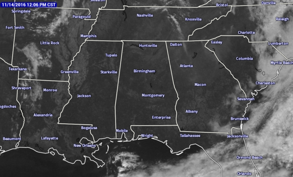
Its a beautiful Monday out there across Central Alabama at the noon hour, with not a cloud in the sky across the area. For the Southeastern U.S., there is cloud cover across portions of the Carolinas and down into Southeast Georgia and the Florida Peninsula. Just a few scattered clouds over parts of East and Central Tennessee, along with Central Arkansas and Northwestern Louisiana.
BIRMINGHAM’S CLIMATOLOGY AND RECORDS
The normal high for November 14th is 65, while the normal low is 42. The record high for today was set back in 1955 at 82. The record low was set back in 1911 at 22.
THE RAIN-FREE STREAK CONTINUES
Today will mark the 57th consecutive day of no rain for the Birmingham area, the longest on record. The last time that measurable rain at the Birmingham Airport was back on September 13th, when a total of 0.32 inches fell. The last time we had a 24-hour rainfall total over 1 inch was back on July 30th when we had 1.33 inches. According to the latest drought monitor data, 52% of Alabama is now classified under an “exceptional” or “extreme” drought condition, which is pretty much all of the northern half of the state. Be sure to conserve water as well, as the Birmingham Water Works remains in a “Stage 4 Drought Emergency.”
NO OUTDOOR BURNING AT ALL
A Drought Emergency continues in effect, banning any outdoor burning for the northern two-thirds of the state. A Fire Alert remains in effect for the whole state. Click here for more information.
REMAINDER OF TODAY
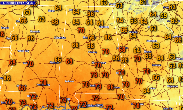
Mostly sunny to sunny skies can be expected in Central Alabama for the remainder of the afternoon. Afternoon highs will be at or near 70 degrees across the area. Skies will be clear across much of the area for the evening and overnight hours, with the exception of some clouds moving in over the northwestern parts after midnight. Lows will be ranging in the 30s and 40s.
TUESDAY’S FORECAST
A mix of sun and clouds can be expected across Central Alabama during the day tomorrow, with clouds being thicker towards the northwestern. Unfortunately, these clouds will not bring any rain chances to our neck of the woods. Afternoon highs will be in the 67 to 73 degree range across the area. Clouds will start to move back out of the area for the evening and overnight hours, and be mostly clear by 10PM. Overnight lows will be ranging in the 30s and 40s.
GULF COAST FORECAST
Sunny days and fair nights on the coast from Gulf Shores to Panama City Beach through the work week and weekend. Highs mostly in the low to mid 70s through Saturday, dropping back into the mid 60s for Sunday. Lows will be in the 50s and 60s. See a very detailed Gulf Coast forecast here.
UPDATE ON THE TROPICS
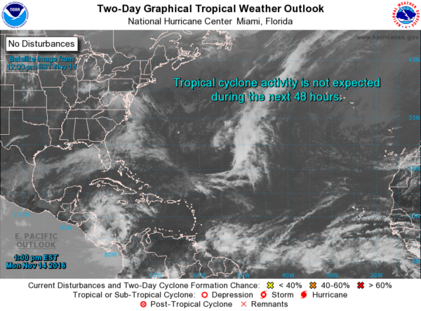
There is a little action happening in the Southwestern Caribbean Sea, as an area of low pressure will move into an atmosphere conducive for slow development. This system could form into a tropical depression late this week, as it drifts to the north-northeast. The NHC is giving this system a 60% chance of formation within the next 5 days.
ON THIS DAY IN 1964
With the help of a fresh three inch cover of snow, the temperature at Ely, NV, dipped to 15 degrees below zero to establish an all-time record low for the month of November. That record of -15 degrees was later equalled on the 19th of November in 1985.
FOLLOW THE BLOG ON TWITTER
Be sure to follow the Alabama Wx Weather Blog on Twitter. Just click here to start following our feed.
WEATHERBRAINS
This is the weekly netcast that’s all about weather featuring many familiar voices, including our meteorologists at ABC 33/40. You can listen anytime on the web, or on iTunes. You can find it here.
Forecaster: Scott Martin (Twitter: @scottmartinwx)
Category: Alabama's Weather


