Mild and Dry but Warmer at Midweek
Clouds are once again scarce in the Alabama sky this morning. The closed upper low over North Alabama plus the easterly flow across South Alabama and South Georgia were combining to produce clouds just to our east so the eastern sections of Alabama along with Southeast Alabama will see more clouds today than the rest of us. Highs will once again be in the middle and upper 60s across Central Alabama with the clouds locations staying a little bit lower.
Your beach forecast includes mainly sunny days and clear nights through the end of next week. Highs will be in the 70s while overnight lows should be in the upper 50s. See the complete Gulf Coast 7 Day Planner here.
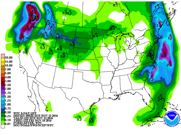
Tropical Atlantic remained quiet. An area of disturbed weather in the Eastern North Pacific is not forecast to amount to much but it will produce heavy rain along the western coast of Mexico. There are no severe thunderstorms forecast by SPC for the next three days.
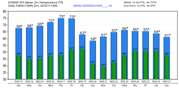
That upper closed low over the Southeast US today will eject off to the northeast fairly quickly on Monday, but we stay in a northwesterly flow aloft so temperatures for high are likely to stay near the 70-degree mark. We should see a pretty good warm up for the middle and end to the week as an strong upper ridge moves over the eastern US. The afternoon high temperatures should climb well into the 70s with the potential for some upper 70s by Thursday and Friday.
As we head into the weekend, a strong upper trough takes shape to our west. The strong upper trough will produce a strong surface low in the vicinity of the western Great Lakes Friday with a cold front trailing southwest into eastern Texas. The GFS and the ECMWF are in fairly close agreement on this pattern giving a nice helping of confidence to the forecast. The trough is forecast to move by us on Saturday and dig into the eastern US on Sunday. As the trough comes by on Saturday, we should see the potential for showers to occur, however, this is still not going to be a drought buster. Unfortunately, the GFS and ECMWF have both gone much less bullish on the potential for any widespread showers or thunderstorms. This means some spots will probably not see any rain at all. As the upper trough digs into the eastern US on Sunday, our temperatures should plunge with highs Sunday only in the 50s. It’s verging into voodoo country, but this pattern suggests the potential for our first widespread freeze on Monday morning.
Going out into voodoo country, the GFS brings the upper ridge back over the eastern US on Wednesday just before Thanksgiving. The pattern suggests that there should not be much in the way of travel issues for those heading out for visits on Thanksgiving. A moderately strong trough is forecast to move into the eastern US around November 27th bringing the possibility of some rain to the Southeast US.
James Spann will be back with the next edition of the Weather Xtreme Video bright and early on Monday morning. Check back with the blog often for updates on the weather for Central Alabama. Have a great day and Godspeed.
-Brian-
Category: Alabama's Weather


