At Midday, Rain Is Close To Central Alabama, But Can We Get Some Help
SAME STORY ON A DIFFERENT DAY
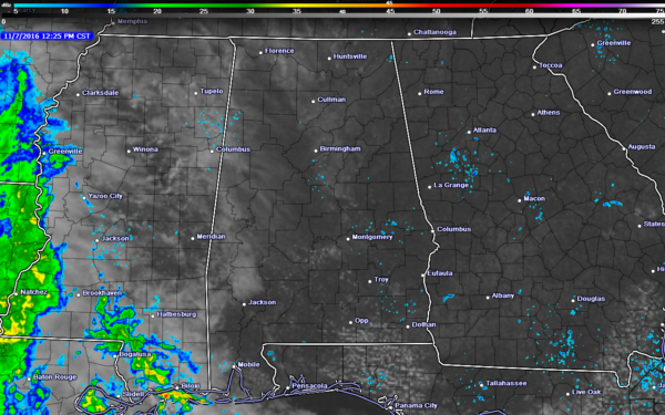
We have reached day 50 of our consecutive dry-streak in Central Alabama, and our drought situation continues to get worse. As you can see by the visible satellite/southeastern radar combo image above, there are numerous showers off to our west in Mississippi, Arkansas, and Louisiana. Unfortunately, that moisture will be pinched off and most of that will stay off to our west. What looks like precipitation in Alabama in the image is ground clutter from the various radar sites.
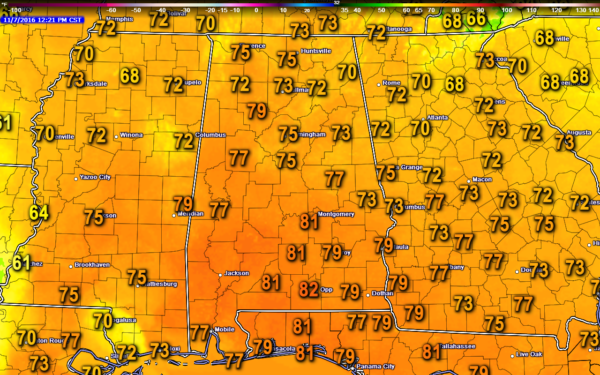
TEMPERATURES ACROSS THE STATE AT 12:15PM CST
Most communities in Central Alabama are up in the low to mid 70s at this point, with warmer temperatures south of the area. The warm spot in the state is Andalusia at 82, while the cool spot is Fort Payne at 70.
NO OUTDOOR BURNING
As today will be our 50th consecutive day in the Birmingham area without any measurable rain, our drought conditions will continue to worsen. A Drought Emergency continues in effect, banning any outdoor burning for the northern two-thirds of the state. A Fire Alert remains in effect for the whole state. Click here for more information.
BIRMINGHAM’S CLIMATOLOGY AND RECORDS
The normal high for November 7th is 67, while the normal low is 44. The record high for today was set back in 2005 at 82. The record low was set back in 1993 at 24.
REST OF TODAY
It will be quite warm out there for this time of the season, as afternoon highs are still around 10 degrees above normal. Skies will be partly cloudy, and afternoon highs will top out in the mid to upper 70s for the most part, with a few communities in the southern part of Central Alabama touching the low 80s. For this evening and the overnight hours, skies will remain partly cloudy and lows will range from the 40 in the eastern parts of the area, to the 50s for the central and western parts.
THE ELECTION DAY FORECAST
A mix of sun and clouds throughout the morning and afternoon hours and a little cooler than today. Places west of a line from Haleyville to Tuscaloosa to Selma could possibly get a few sprinkles to an isolated shower. If any rain falls, amounts will be very light, perhaps a few hundredths of an inch or less. Odds for any one spot in that area getting any precipitation at all are one in five closest to the AL/MS state line, and drop quickly as you move east. Otherwise, the rest of Central Alabama will remain dry. Afternoon highs will be in the low to mid 70s. Skies will become mostly cloudy to almost completely overcast for the evening, and overnight lows will mostly be in the upper 40s to low 50s.
HEADED TO THE BEACH
Expect cloudy periods today through Wednesday with a few passing rain showers, then sunny days and clear nights Thursday through the weekend. Highs will be mostly in the 70s. See a very detailed Gulf Coast forecast here.
THE TROPICS
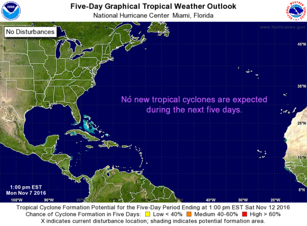
The Atlantic Basin is quiet, and tropical storm formation is not expected through the next five days. Good news is that the Atlantic Hurricane Season comes to a close at the end of this month.
ON THIS DAY IN 1989
Shortly after daybreak strong thunderstorms developed over a narrow, but almost stationary, east-west band across New Orleans, in southeastern Louisiana. As a result, heavy rains persisted over the same area until mid afternoon before tapering off, and triggered flash flooding across a five county area. Eight to twelve inch rains deluged the area between 9 AM and 6 PM, and totals for the 48 hour period ending at 7 AM on the 8th ranged up to 19.78 inches, between Lake Lexy and Lake Borgne. Approximately 6000 homes in the area reported water damage. The rainfall total for November of 19.81 inches at New Orleans was their highest total for any given month of the year.
FOLLOW THE ALABAMA WX WEATHER BLOG ON TWITTER
Be sure to follow the Alabama Wx Weather Blog on Twitter. Just click here to start following our feed.
WEATHERBRAINS
This is the weekly netcast that’s all about weather featuring many familiar voices, including our meteorologists at ABC 33/40. You can listen anytime on the web, or on iTunes. You can find it here.
Forecaster: Scott Martin (Twitter: @scottmartinwx)
Monday Midday, November 7, 2016
Category: Alabama's Weather


