It’s 15 to 20 Degrees Cooler Out There at Midday
FALL IS FINALLY HERE IN CENTRAL ALABAMA:
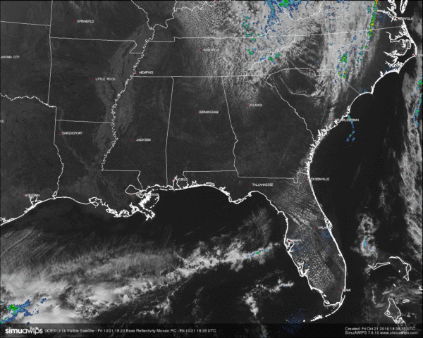
After the cold front moved through last night, temperatures at this hour are currently 15 to 20 degrees cooler than at this time yesterday. Skies are starting to clear out completely, and radar is completely free of any rainfall. Unfortunately, rain will not be in the forecast through the next seven days.
RED FLAG WARNING:
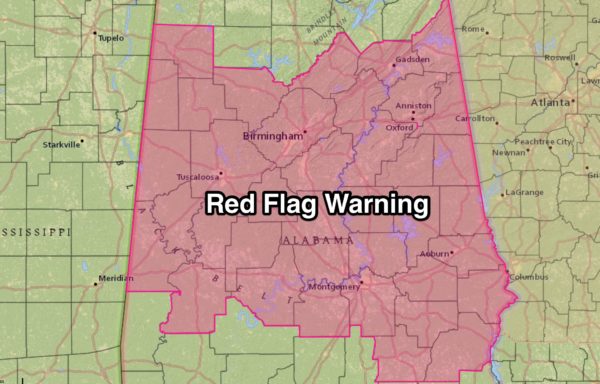
A Red Flag Warning is in effect until 6:00 PM CDT this evening for all of Central Alabama. The dry airmass that is in place over the area, along with the breezy conditions, will result in critical fire weather conditions.
BURN BAN AND FIRE ALERT:
A Drought Emergency continues in effect, banning any outdoor burning for the northern two-thirds of the state. A Fire Alert remains in effect for the whole state. Only those counties outside of the Drought Emergency can burn outdoors after obtaining a burn permit from the Alabama Forestry Commission, but these will be restricted and issued on an individual basis. Click here for more information.
TEMPERATURES ACROSS CENTRAL ALABAMA AT 1:15 PM CDT:
- Birmingham 68
- Tuscaloosa 70
- Gadsden 68
- Anniston 68
- Cullman 64
- Alexander City 70
- Auburn 70
- Selma 72
- Montgomery 74
AIR QUALITY:
Both Ozone and Particulate Matter 2.5 levels will be below criteria to raise an Air Quality Alert for the Birmingham metropolitan area today. No actions needed.
NORMS AND RECS FOR TODAY IN BIRMINGHAM:
The normal high for October 21st is 73, while the normal low is 49. The record high for today was set back in 1963 at 89. The record low was set back in 1913 at 30.
REST OF TODAY:
Skies will continue to clear out throughout the remainder of the afternoon, and winds will be breezy at times out of the north at 10 to 15 MPH, with gusts up to 25 MPH possible. Afternoon highs will range in the mid 60s to the low 70s throughout the area. Skies will be clear during the overnight hours, with lows in the upper 30s to the mid 40s, with colder spots possibly getting close to freezing.
FRIDAY NIGHT FOOTBALL:
Skies will be clear tonight and temperatures will start off in the 60s at kickoff, and will be falling into the 50s by the final whistle.
TOMORROW’S FORECAST:
The sun will be out in full force for your Saturday. The morning will start off pretty chilly out there, in the 40s. Temperatures will only make it into the upper 60s to low 70s for the afternoon highs.
ALABAMA FOOTBALL:
Alabama will host Texas A&M tomorrow afternoon at Bryant-Denny Stadium (2:30p CT kickoff)… the sky will be sunny; 68 degrees at kickoff, falling into the upper 50s by the final whistle.
AUBURN FOOTBALL:
Auburn hosts Arkansas at Jordan-Hare Stadium tomorrow evening (5:00p CT kickoff)… the sky will be clear with temperatures falling from near 67 degrees at kickoff, into the upper 50s by the end of the game.
RACE WEEKEND AT TALLADEGA:
Today will be breezy and much cooler with a sunny sky, and a high in the mid to upper 60s. Expect a bright sunny sky tomorrow and Sunday with fantastic temperatures; the high tomorrow will be close to 68, followed by a high of 75 Sunday. Temperatures will drop to near 40 degrees early tomorrow and Sunday morning at the Superspeedway.
NEXT WEEK:
Sunny pleasant days and clear cool nights; unfortunately no sign of rain at this point. The latest GFS does hint at the chance of light rain around Saturday October 29.
HEADED TO THE BEACH:
Sunny days, fair nights through next week with highs 75-80, and lows in the 56-62 degree range. See a very detailed Gulf Coast forecast here.
TROPICAL UPDATE:
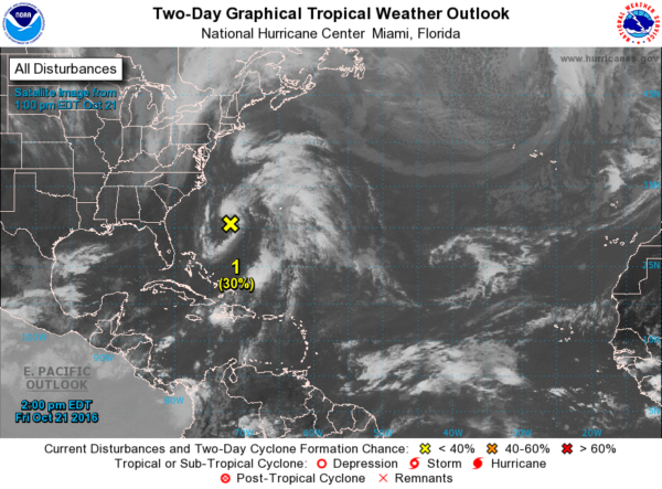
The disturbance northeast of the Bahamas remains disorganized, and the rest of the Atlantic basin is quiet.
ON THIS DAY IN 1988:
Joan, the last hurricane of the season, neared the coast of Nicaragua packing 125 mph winds. Joan claimed more than 200 lives as she moved over Central America, and total damage approached 1.5 billion dollars. Crossing more than 40 degrees of longitude, Hurricane Joan never strayed even one degree from the 12 degree north parallel.
THE BLOG IS ON TWITTER:
Be sure to follow the Alabama Wx Weather Blog on Twitter. Just click here to start following our feed.
WEATHERBRAINS:
This is the weekly netcast that’s all about weather featuring many familiar voices, including our meteorologists at ABC 33/40. You can listen anytime on the web, or on iTunes. You can find it here.
ADVERTISE WITH US:
Deliver your message to a highly engaged audience by advertising on the AlabamaWX.com website. The site enjoyed 10.2 MILLION pageviews in the past 12 months. Don’t miss out! We can customize a creative, flexible and affordable package that will suit your organization’s needs. Contact Bill Murray at (205) 687-0782.
Category: Alabama's Weather


