Will the Record Be Unbroken? By and By, We Will Tell.
By and by, we will find out whether the U.S. streak of no landfalling major hurricanes will remain intact. It was been 10 years 11 months and 2 days since a major hurricane hit the United States (Hurricane Wilma on October 24, 2005). That record obliterated the old record of eight years set in the 1860s. That’s 131 months 2 days. That’s 570 weeks. That’s an amazing 3,990 days.
DROUGHT BUSTER? Often, we look to dying tropical systems to spell the end of a southeastern drought. Let’s just hope it does come on the business end of a major hurricane.
MATTHEW THIS WEEK? The tropical wave that will likely become Matthew most likely is about 1350 miles east of the southern Windward Islands this afternoon. Low pressure should develop by Tuesday as the system approaches the southern Antilles. There is a chance that it will be a tropical storm as it enters the southeastern Caribbean. It will be very far to the south, hugging the coast of Venezuela before entering the Central Caribbean late next week. Then it will be entering very favorable conditions and we could be dealing with a major hurricane as it approaches Jamaica or Hispaniola next weekend.
IMPOSSIBLE TO SAY: After that it could affect Cuba, the Florida Keys, western Florida, the Florida Panhandle, the Central Gulf Coast, the Bahama, or Mexico. It could miss the United States entirely. Nothing like a specific forecast, huh? But it is just impossible to say at this point. Suffice to say, everyone with interests along the Gulf Coast will want to keep one eye on the progress of the system over the coming two weeks.
MODEL MADNESS: It’s still model madness and a voodoo sandwich at this point, with every run of the model controls pointing to a very different solution. The ensemble output of the two global models is still all over the board as one would expect, but some consistency did emerge last night and this morning.
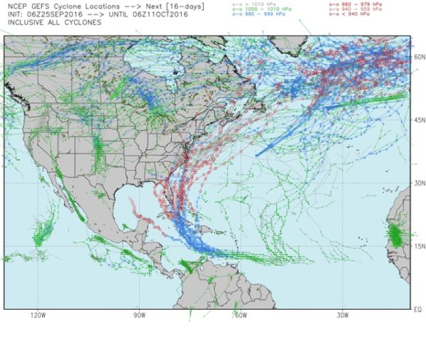
Here is the output of the GFS Ensembles showing possible tracks. You can see that it is focusing on the area between the Florida Keys, South Florida and the Bahamas up into the Carolinas.
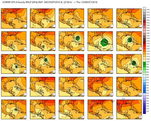
Here is one set of the European model’s individual ensemble members for Thursday morning the 6th based on last evening’s run. The ensemble runs come by varying the input slightly each time to produce a different possible result. When there is good agreement among the members, you have have more confidence in that model run. You can see all of the different ideas on the table in the various outputs:
The just shows some of the various options on the table for no.
There is actually one more set of ensemble outputs to go with these. But I counted up all 50 ensemble members this morning, and the winner (or loser) was the Florida Keys or the Bahamas with 16 of the 50 runs targeting them. There was about a 50/50 split between the Keys and the Bahamas. Interesting to note that Alabama/Mississippi region showed as a landfall point for 4 of the members. The biggest majority was no storm or no landfall. That seems unrealistic at this time.
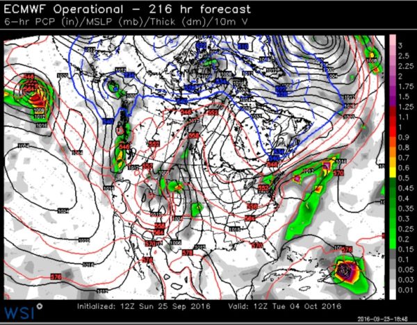
Here is the control run of the European from the morning. It shows a hard right turn into Hispaniola on Wednesday on Tuesday October 4th.
Here is the control from the GFS for the same time:
It shows a similar solution to the European. If that materializes, the U.S. landfalling major hurricane record may remain remain unbroken. And we shall remain dry.
REST OF THE TROPICS: Karl is now a post tropical storm over the North Atlantic. Advisories have been discontinued. Karl passed south of Bermuda Friday night and Saturday morning, bringing tropical storm force gusts to the island nation along with heavy rains. About 800 homes were without power yesterday and there were big swells and waves. No injuries were reported. Bermuda is used to passing hurricanes.
Category: Tropical


