Depression Eight Forms
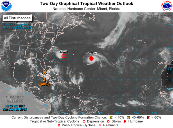
A new tropical depression has formed this morning, but those of you watching the tropical Atlantic may be surprised to learn it is NOT the one progressing through the Florida Straits. No, it is not that one, but it is the one that is west of Bermuda headed west.
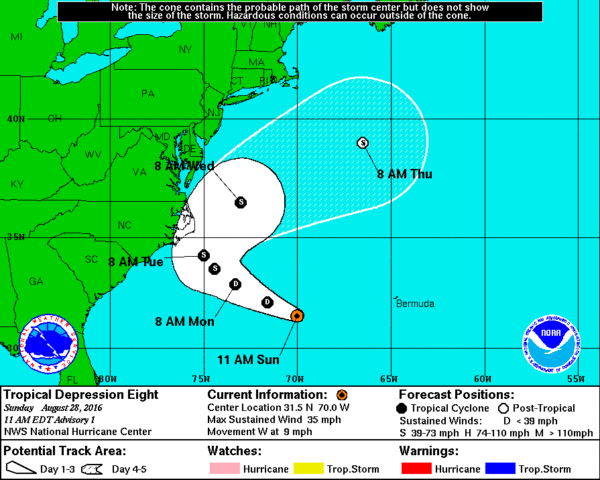
There are currently no coastal watches or warnings in effect, but all interests along the Outer Banks of North Carolina should monitor
the progress of this depression. A tropical storm watch may be required for part of this area later today.
At 10:00 am CDT, the center of Tropical Depression Eight was located near latitude 31.5 North, longitude 70.0 West. The depression is moving toward the west near 9 mph. A west-northwestward motion is expected later today and tonight followed by a turn toward the northwest and a decrease in forward speed on Monday. Based on the forecast track, the center of the storm will pass offshore of the Outer Banks of North Carolina on Tuesday.
Maximum sustained winds are currently near 35 mph with higher gusts. Some strengthening is possible in the next couple of days, and the depression may reach tropical storm strength on Monday. The estimated minimum central pressure based on data from NOAA buoy 41048 is 1009 mb or 29.80 inches.
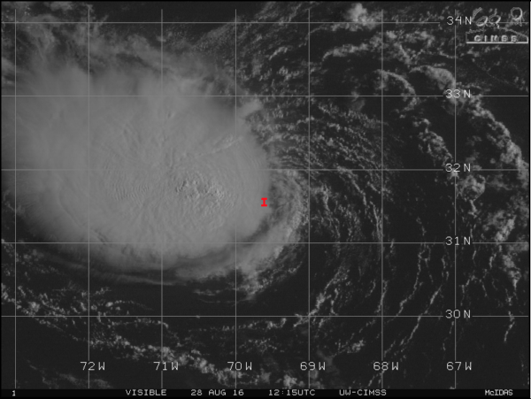
Convection associated with the area of low pressure located west of Bermuda has increased markedly since 06Z. Given this and the well-defined center shown by an overnight ASCAT pass, advisories are now being initiated on this system as a tropical cyclone (depression). The initial intensity is estimated to be 30 kt based on the latest Dvorak estimates of T2.0/30 kt from TAFB and SAB. An Air Force Reserve Hurricane Hunter aircraft is scheduled to investigate the depression this afternoon.
The environment is currently only marginally conducive for intensification with moderate southeasterly to easterly shear expected to become southwesterly and increase further in 36 to 48 hours. As a result, only modest strengthening is shown in the official forecast, with the depression expected to become a tropical storm in the next day or two. After that time, the global models show the cyclone opening up along a frontal zone well offshore of the northeastern United States. However, there is some disagreement in when this will occur, with the GFS showing the cyclone dissipating in about 3 days, and the ECMWF hanging onto it until around day 5. The NHC forecast compromises on this showing dissipation after day 4, but this timing is quite uncertain.
The depression is currently situated south of a mid-level ridge that extends from the Mid-Atlantic states into the western Atlantic with an initial motion estimate of 280 degrees at 8 knots. The ridge is forecast to break down and shift eastward during the next 2-3 days, which should result in the cyclone gradually turning poleward and then recurving during the next 72 hours. The NHC track forecast is close to a blend of the GFS and ECMWF models through dissipation. This forecast keeps the center of the cyclone east of the Outer Banks of North Carolina, but a tropical storm watch may be needed for that area later today.
You may be inclined to think that this system is the remnant of Fiona. However, based on an evaluation of satellite imagery and data during the past
few days by NHC, it appears that the remnants of Tropical Storm Fiona are not directly responsible for the genesis of this depression. The Fiona remnants were absorbed into a separate area of pre-existing vorticity, with the current depression developing out of the combined system. As a result, this is considered to be a new tropical cyclone, not a regeneration of a previous tropical cyclone.
The National Hurricane Center (NHC) will issue the next advisory at 5:00 pm EDT.
-Brian-
Category: Tropical


