Midday Nowcast: Scattered Showers & Storms Out There
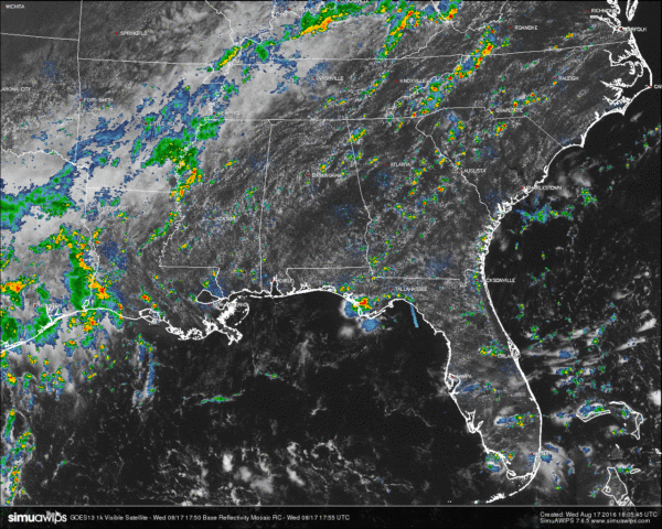
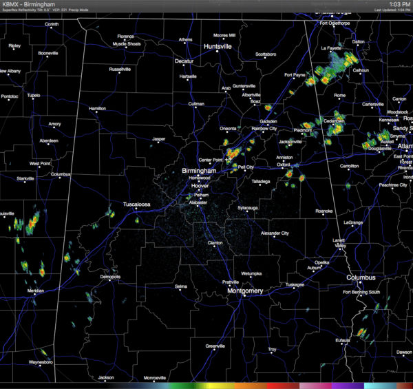
Currently across Central Alabama, skies are mostly sunny with convective clouds starting to build, and with those convective clouds, we have convective showers and storms popping on radar. The main action is currently over western St. Clair and over southern Cherokee and northern Cleburne counties. One heavy shower in between Springville and Odenville has already put down a radar-estimated 0.66 inches within the last 50 minutes. All shower activity is moving to the northeast.
TEMPERATURES AT THIS HOUR: With mostly clear skies, the heat is building up towards the daytime highs. Here is a list of temperature observations from across the area:
Birmingham 87
Tuscaloosa 88
Gadsden 88
Anniston 90
Cullman 87
Jasper 91
Alexander City 88
Selma 88
Montgomery 91
CODE GREEN AIR QUALITY: The Air Quality Index for the Birmingham Metropolitan Area is in the “Code Green” for particulate matter 2.5. No actions needed.
TODAY’S CLIMATOLOGY FOR BIRMINGHAM: The normal high for August 16th is 90, while the normal low is 69. The record high for today was set back in 1995 at 102. The record low was set back in 1992 at 63.
WHAT TO EXPECT FOR TODAY: Skies will generally be partly to mostly clear for the remainder of the afternoon and evening hours, with a risk for scattered showers and thunderstorms. Looking at the latest data, the main focus for shower activity looks to be over the north and eastern parts of the area, as moisture pooling is taking place. Afternoon highs will be in the low to mid 90s. Odds for any one spot getting rain is around one in three.
THURSDAY’S WEATHER: A more unstable airmass will be over the area as the ridge over the deep south weakens and the air aloft will be a little bit cooler. A mix of sun and clouds can be expected, with an increased risk of scattered showers and thunderstorms. Afternoon highs will be in the upper 80s to just over 90 degrees. The odds of any one spot getting rain will be close to 50/50.
HEADED TO THE BEACH: About 7 to 9 hours of sunshine daily on the coast from Gulf Shores to Panama City Beach through the weekend with widely scattered showers/storms. Highs upper 80s on the immediate coast, with low 90s inland. Sea water temperatures are mostly in the mid to upper 80s. See a very detailed Gulf Coast forecast here.
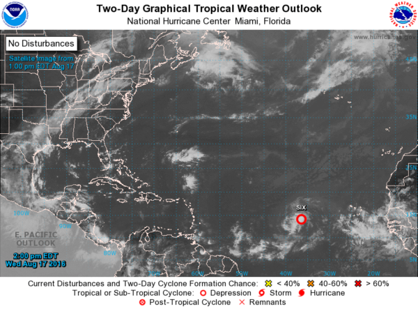
THE TROPICS: Tropical Depression 6 has formed in the central Atlantic Ocean and is expected to become Tropical Storm Fiona later today. Latest guidance has it staying well away from any land, and will just be pestering the fish. Another tropical wave will move off the coast of Africa later this week and slow development is expected. We’ll have to keep our eyes open as we are now heading into peak hurricane season.
ON THIS DAY IN 1989: Morning thunderstorms produced three to six inch rains in Oklahoma, and the Arkalatex area of Arkansas, Texas and Louisiana. Tom OK was soaked with 5.98 inches of rain, and Foreman AR received 5.55 inches. Evening thunderstorms produced high winds in the Wasatch Front of northern Utah. Thunderstorm winds gusted to 66 mph at Salt Lake City, and flash flooding caused up to two million dollars damage to a marina on Lake Powell.
THE BLOG IS ON TWITTER: Be sure to follow the Alabama Wx Weather Blog on Twitter. Just click here to start following our feed.
WEATHERBRAINS: This week, we previewed the upcoming National Weather Association Annual Meeting with the President, Executive Director, Social Media Chair and Program Chair. This is the show all about weather featuring many familiar voices, including our meteorologists at ABC 33/40. You can listen anytime on the web, or on iTunes. You can find it here.
ADVERTISE WITH US: Deliver your message to a highly engaged audience by advertising on the AlabamaWX.com website. The site enjoyed 10.2 MILLION pageviews in the past 12 months. Don’t miss out! We can customize a creative, flexible and affordable package that will suit your organization’s needs. Contact Bill Murray at (205) 687-0782.
Category: Alabama's Weather


