Midday Nowcast: Another Hot Day, Followed By A Hot Weekend
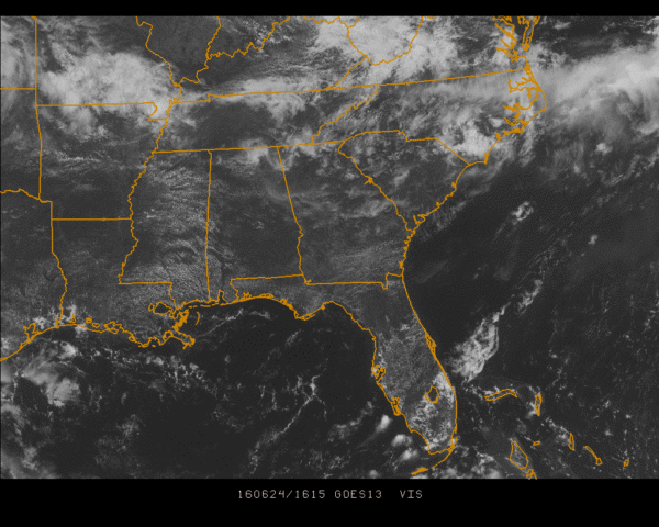
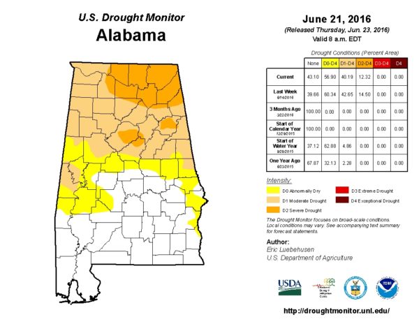
At the noon time hour across Central Alabama, skies are mostly clear with the exception of a few cirrocumulus floating overhead. Radar at this time is free of any rainfall, which is actually not good news because parts of Alabama are listed under severe drought conditions by the U.S. Drought Monitor. Hopefully with the remnants of a couple of MCSs moving through Tennessee leaving mesoscale boundaries across the state will be the catalyst for a few scattered showers and thunderstorms to develop.
TEMPERATURES ACROSS CENTRAL ALABAMA: At the 12:00 PM hour, temperatures across Central Alabama were well up into the 80s. Here is a list of readings from across the state:
Birmingham: 89
Anniston: 87
Tuscaloosa: 88
Muscle Shoals: 86
Huntsville: 86
Alexander City: 88
Montgomery: 89
Dothan: 88
Mobile: 89
REST OF TODAY: Skies should remain mostly clear with a good supply of sunshine. As usual in the summertime, a small risk for an afternoon or evening shower or storm developing is possible, but most places in Central Alabama should remain dry. Afternoon highs will be in the mid 90s.
CODE YELLOW AIR QUALITY: The Air Quality Index for the Birmingham Metropolitan Area will be in the “Code Yellow” (moderate range) for particulate matter. People who are unusually sensitive should consider limiting prolonged outdoor exertion.
TODAY’S CLIMATOLOGY FOR BIRMINGHAM: The normal high for June 24th is 89, while the normal low is 67. The record high for today was set back in 1981 at 99. The record low was set back in 1972 at 54.
WEEKEND WEATHER: A big heat ridge moves over the eastern half of the country on Saturday, so highs will be in the middle and upper 90s. Heat indices will be flirting with the 105 value, so a heat advisory may be required. Just be aware of the heat and slow down your outdoor activities and be sure to stay hydrated by drinking water. The heat continues into Sunday with another hot day with highs in the mid to upper 90s. Again, a heat advisory may be necessary.
HEADED TO THE BEACH: This weekend promises to be beautiful along Alabama and Northwest Florida beaches. It will be seasonably hot, with highs near 90 and lows in the middle 70s. Rain chances will pick up by Monday afternoon and will be fairly high Monday afternoon through Wednesday. Water temperatures were in the middle 80s at the Dauphin Island Sea Lab. See a very detailed Gulf Coast forecast here.
THE TROPICS: The tropics remain quiet. A large area of cloudiness was noted over the western Caribbean and the Yucatan Peninsula. Any development of this area will be slow to occur as it moves on a motion to the west-northwest.
WEATHERBRAINS: This is the show all about weather featuring many familiar voices, including our meteorologists at ABC 33/40. This week, the panel entertained Dr. James Fleming from Colby College. Dr. Fleming is a weather and climate historian. You’ll love his stories about the history of weather modification and biographies of weather luminaries Bjerknes, Rossby and Wexler. You can listen anytime on the web, or on iTunes. You can find it here.
Category: Alabama's Weather


