Midday Nowcast: A Warmer Day Today, Rain Chances Still Very Small
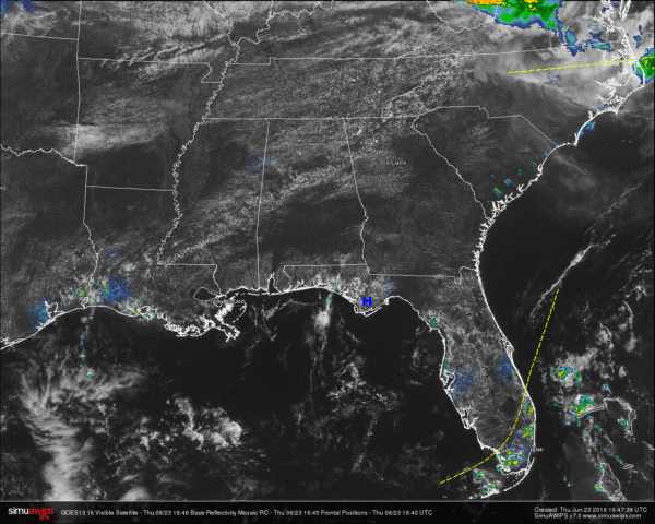
At the noon time hour across Central Alabama, skies are mostly clear to partly cloudy and nearly everyone is dry. There are a few isolated showers that have popped up on radar. Two decent showers have formed in Sumter County, one just west of Emelie and the other just southwest of Geiger. The other shower is located just northeast of Moundville in Tuscaloosa County. These are moving off to the east.
The shower activity that moved across parts of Tuscaloosa, Jefferson, and St. Clair counties have dissipated. A small shortwave is in the progress of moving across the state, and those showers formed along that wave. It has now moved into drier air aloft and there should be no more showers forming along it.
TORNADO KILLS 51 IN CHINA: At the latest report from the city of Yancheng in the Jiangsu Province, severe thunderstorms moved through the area around 2:30 PM local time. A tornado developed and flattened factories and vehicles were swept away. Latest report says 51 dead and dozens injured.
TEMPERATURES ACROSS CENTRAL ALABAMA: At the 12:00 PM hour, temperatures across Central Alabama were well up into the 80s. Here is a list of readings from across the state:
Birmingham: 85
Anniston: 86
Tuscaloosa: 83
Muscle Shoals: 89
Huntsville: 88
Alexander City: 87
Montgomery: 86
Dothan: 86
Mobile: 87
REST OF TODAY: Mostly clear skies will persist for Central Alabama through the remainder of the day. Most communities in the area will remain dry, but a very small risk of an afternoon or evening shower is possible, especially for areas north and west of the I-59 corridor. Once we lose the sun heating the air, any showers should dissipate quickly. Afternoon highs will be in the mid 90s, with a few spots reaching the upper 90s.
CODE YELLOW AIR QUALITY: The Air Quality Index for the Birmingham Metropolitan Area will be in the “Code Yellow” (moderate range) for particulate matter. People who are unusually sensitive should consider limiting prolonged outdoor exertion.
TODAY’S CLIMATOLOGY FOR BIRMINGHAM: The normal high for June 23rd is 89, while the normal low is 67. The record high for today was set back in 1897 at 100. The record low was set back in 1972 at 48.
TOMORROW’S WEATHER: Little change in our weather for tomorrow. Skies will be mostly sunny and hot afternoon temperatures are expected. Many locations should see highs in the mid to upper 90s, and with higher humidity values, heat index values will be near or over the 100° mark. Once again, most locations in Central Alabama will remain dry, but there is a very small risk for an afternoon or evening shower.
HEADED TO THE BEACH: The rest of this week and into the weekend promises to be beautiful along the beaches of Alabama and Northwest Florida. It will be seasonably hot with highs near 90 and lows in the middle 70s. Rain chances will pick up by Monday afternoon and will be fairly high Monday afternoon through Wednesday. Water temperatures remained warm with 83 degrees reported at the Dauphin Island Sea Lab. See a very detailed Gulf Coast forecast here.
THE TROPICS: The tropics remain quiet. A large area of cloudiness was noted over the western Caribbean and the Yucatan Peninsula, but there were no signs of any development in that area. Looking out into voodoo country, tropical weather enthusiasts will probably like what the GFS is cooking up now. From July 4th through July 6th the GFS picks up on what could be another tropical system in the Gulf of Mexico that takes aim for Louisiana. We’ll watch this feature in future runs, IF its there.
WEATHERBRAINS: This is the show all about weather featuring many familiar voices, including our meteorologists at ABC 33/40. This week, the panel entertained Dr. James Fleming from Colby College. Dr. Fleming is a weather and climate historian. You’ll love his stories about the history of weather modification and biographies of weather luminaries Bjerknes, Rossby and Wexler. You can listen anytime on the web, or on iTunes. You can find it here.
Category: Alabama's Weather


