Tropical Mischief Coming?
As James has been noting in the Weather Xtreme Video, there is some tropical mischief brewing in the western sections of the Caribbean Sea that may become our next tropical system. Understand that this is early, but the National Hurricane Center (NHC) is talking about it, and the major global models have been suggesting this for the last couple of days. So I thought it might be worth a little analysis here.
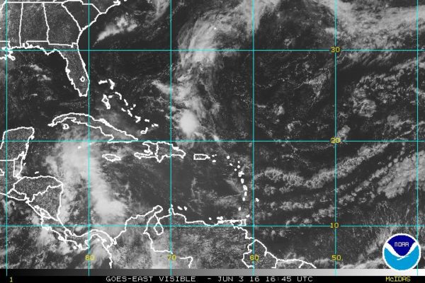
First, let’s start with the actual situation. NHC has noted a large area of showers and thunderstorms continued over the western Caribbean Sea. This system was moving west-northwestward toward the Yucatan Peninsula of Mexico, and a low pressure area is expected to form over the Yucatan or the adjacent waters over the weekend. After that, this low could develop into a tropical cyclone as it moves across the eastern Gulf of Mexico and the Florida Peninsula early next week (Monday-Tuesday time frame). Regardless of storm development, locally heavy rains and flooding are going to be possible over portions of the Yucatan Peninsula, western Cuba, and the Florida Peninsula during the next several days. NHC puts the chance of formation through the next 5 days at 60 percent. Here is the latest satellite image of the disorganized area of showers and thunderstorms in the western Caribbean.
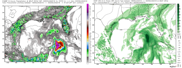
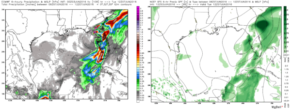
Looking at the latest model runs, that means the 00Z run from the ECMWF and the 12Z run from the GFS, the two models are actually in fairly close agreement on what the future holds. If both of these models are right, then we can expect to see a tropical storm form over the weekend and move fairly rapidly across the eastern Gulf of Mexico Monday and across the northern half of the Florida Peninsula on Tuesday. Here is a comparison of the two models at the same time, 00Z June 6th in the first panel, and 12Z June 7th in the second panel.
You can click on either of these panels for larger graphics.
As you can see upon close examination, they are very close. Sure, there are some minor differences, but they are minor. For example, the GFS is slightly larger with the 1004 millibar circle than the ECMWF in the first set of panels. In the second set of panels, the ECMWF has kept a slightly stronger system, but again relatively minor at only 2 millibars difference. Using an approximately center of the low pressure area reveals a track that is good agreement.
If this system behaves as the models are suggesting, it would be named Colin since we’ve already had Alex (in January) and Bonnie (in late May and early June).
For those that may have vacation plans toward the Gulf Coast or perhaps into the Florida peninsula, there is no reason to consider cancelling your plans. There is every reason to believe that this future system will have little inclement weather impact on the Gulf beaches from Mississippi to Apalachicola. For North Florida all the way south to the Keys, there is likely to be some wind along with heavy rain. But the forward speed of the system should result in only a limited period of really inclement weather for most locations.
Stay with the blog for later updates and information on what this system eventually does. We’ll be keeping our eyes on it.
-Brian-
Category: Tropical


