Nice Weekend but Getting Hotter Next Week
A cold front was making its way slowly through Central Alabama this morning. As a result, there were a couple of showers showing up on radar near Albertville and in the area from Jacksonville to just northeast of Piedmont. Isolated showers along with a low stratus deck will continue through the mid-morning hours, but by early afternoon the threat for showers should diminish and the sky clear as the weak front pushes much further south of Central Alabama. The high today should reach near 80 degrees.
Not much change in the weather pattern for Central Alabama as the trough moves to the East Coast while the ridge to our west inches closer. Look for sunshine and highs around 80 degrees once again.
For those headed to the beach, there may be an isolated storm today, but look for mostly sunny days and fair nights Sunday through much of next week from Panama City Beach over to Gulf Shores and Dauphin Island; great weather for the rest of the Hangout Music Festival. Highs on the immediate coast will be in the lower 80s with lows around 70 degrees. Water temperature along the coast was running around 78 degrees. See a very detailed beach forecast here.
Mostly sunny and warm weather is expected at Greystone today and Sunday with afternoon highs around 80 degrees. A great weekend for golf. Find out more information and purchase your tickets here.
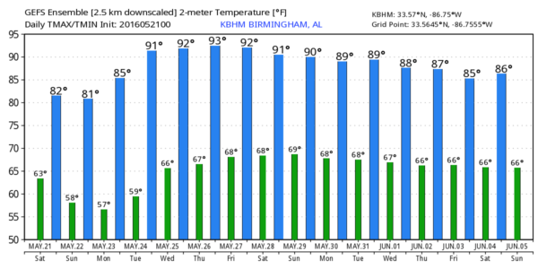
Don’t forget that the SEC Baseball Tournament is coming up at the Hoover Met May 24th through the 29th. The weather looks pretty good during the tournament; there could be isolated afternoon showers from Wednesday through the end of next week, but nothing widespread is anticipated. Heat levels crank up with afternoon highs in the 87-90 degree range on most days. Find out more information and purchase your tickets here.
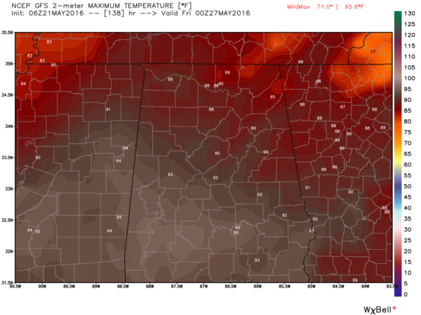
Monday through Thursday, the upper ridge to the west today will move over the eastern US setting up a pattern for some rather warm days as highs climb toward the 90-degree mark. I think we stay dry until around Wednesday and Thursday when we may begin to see the potential for the afternoon heat to create isolated thunderstorms. Even so, most of us will stay dry, but the afternoon highs will be well into the upper 80s and some spots could see a high of 90 to 92.
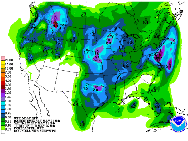
While we see an upper level ridge as the primary feature in the pattern for the eastern half of the country, a deep trough will be the primary feature over the western US. This keeps the biggest threat for organized severe storms to remain in the Central Plains through much of the upcoming week with a surface low in Kansas Friday and Saturday. With the strong ridge holding and a strong short wave ejecting out across Kansas and Nebraska on Saturday, we should stay warm with thunderstorms becoming a little more numerous but still mainly scattered.
Looking into voodoo country, and the GFS has a very interesting feature that actually starts on Saturday, May 28, and continues all the way to June 2nd. The GFS develops an upper closed low in the vicinity of South Florida on Saturday the 28th and moves that feature to the Alabama/Northwest Florida coast on Monday, May 30th. It then holds it together along with a surface low moving them both westward along the Gulf Coast through June 2nd before stalling it off the Texas/Louisiana coast for a couple of days. That feature then gets picked up by a strong trough moving out of the North Central US around June 6th. Interesting to note that the European has no such feature at all! So, is this real or simply voodoo? Only time will tell, but this is a good time to remind everyone that we’ve already had Alex, so should this feature come alive as the GFS suggests, it would be named Bonnie. Being a realist, the chances are quite high that this feature will disappear in the GFS run tomorrow morning – so stay tuned.
Meaghan Thomas and I will be heading to Altoona today for a community event where we’ll focus on severe weather safety. If you can, come on by and say hello. I expect to have the next Weather Xtreme Video posted here first thing on Sunday morning. Have a blessed day and Godspeed.
-Brian-
Category: Alabama's Weather


