Thursday Midday Nowcast for North/Central Alabama
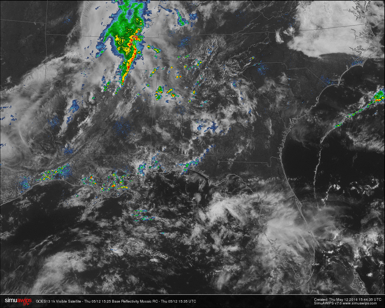
ACROSS THE AREA: Scattered showers have already started popping up across the area at this hour. A decent thunderstorm is moving to the northeast over west-central Walker County and will soon be affecting Jasper. Two more decent heavy showers are currently affecting Lamar and Southwest Marion Counties. A few more are over Northeastern St. Clair and Southwestern Etowah Counties, Eastern Cullman and Northwestern Blount Counties, and up to the north in Northeastern Lawrence and Northwestern Morgan Counties.
AROUND THE U.S.: A line of showers and thunderstorms is currently along the Mississippi River stretching from western Kentucky down to Northwestern Mississippi. More isolated showers have developed along the Gulf Coast stretching from near Houston, Texas, to Destin, Florida. As of now, there are no severe warnings in effect.
QUICK LOOK AT TEMPERATURES: Temperatures across the state have already warmed up well into the 70s for most communities in Alabama. Here is a list of temperature readings from across the state at this time:
Birmingham 73
Tuscaloosa 78
Muscle Shoals 77
Huntsville 81
Anniston 79
Alexander City 78
Montgomery 76
Dothan 80
Mobile 79
REST OF TODAY: Expect a mix of clouds and sun for the rest of today, with a likelihood of scattered showers and thunderstorms developing this afternoon. Highs will reach the mid 80s for most communities. A more organized line of showers and thunderstorms will likely move in over North Alabama later tonight ahead of a cold front.
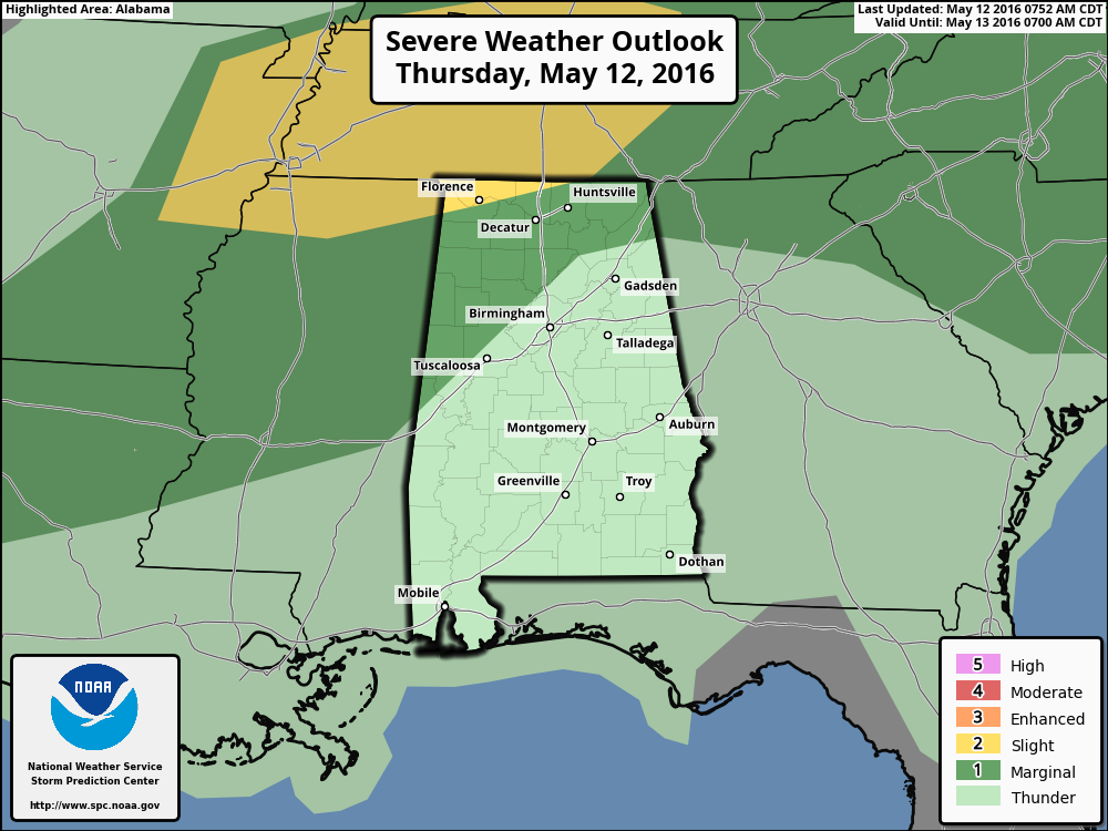
The SPC has included much of the northern quarter of the state in a “Marginal Risk” of severe storms, with the northwestern corner, including Florence and Muscle Shoals, under the standard “Slight Risk” of severe storms. A major severe weather problem is not expected, as the main dynamic support will pass far to the north of Alabama. A few of the stronger storms could produce gusty winds and some hail. Rain totals should average around 1/2 inch for most areas. The main window for the stronger storms will come from 5:00 PM until 9:00 PM.
FRIDAY: Cooler and drier air moves in tonight after the cold front moves through, and that will set the stage for some really nice weather tomorrow. Sunny skies and highs reaching at or near 80.
HEADED TO THE BEACH: A few scattered storms are possible tomorrow, otherwise expect mostly sunny days and fair nights from Gulf Shores to Panama City Beach through early next week. Highs will be around 80 on the immediate coast, with mid 80s inland. See a very detailed beach forecast here.
THE REGIONS TRADITION: The Regions Tradition will be held this year at the Greystone Golf and Country Club May 18-22… early data suggests the highest risk of showers will come Wednesday and Thursday (May 18-19), followed by mostly dry weather Friday through the weekend (May 20-22). Find out more information and purchase your tickets here.
WEATHERBRAINS: Don’t forget you can listen to our weekly 90 minute netcast anytime on the web, or on iTunes. This is the show all about weather featuring many familiar voices, including our meteorologists here at ABC 33/40. You can find it here.
Category: Alabama's Weather
About the Author (Author Profile)
Scott Martin is an operational meteorologist, professional graphic artist, musician, husband, and father. Not only is Scott a member of the National Weather Association, but he is also the Central Alabama Chapter of the NWA president. Scott is also the co-founder of Racecast Weather, which provides forecasts for many racing series across the USA. He also supplies forecasts for the BassMaster Elite Series events including the BassMaster Classic.Subscribe
If you enjoyed this article, subscribe to receive more just like it.


