More Showers and Storms
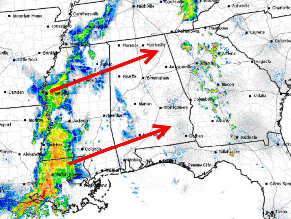
Most of the day has been rather decent with with a mix of sun and clouds, but clouds are on the increase once again, as a complex of showers and storms is moving across Mississippi and will be arriving in Alabama later today. Also, additional showers and storms are developing ahead of the main complex.
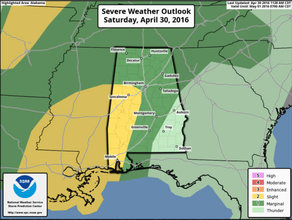
The SPC has much of West & Southwest Alabama highlighted in their standard “slight risk” of severe weather today. This risk area is essentially along the U.S. 43 corridor from Fayette and Tuscaloosa counties, south through Demopolis, all the way down to Mobile. East of this area, a “marginal risk” covers much of the rest of Alabama.
Much like we saw yesterday, storms that impact Alabama could produce damaging wind gusts, and large hail. The tornado threat if very low, but not zero. The main impact from storms will be over western portions of the state. Timing on the storms will be later this afternoon, and through the evening hours, but storms should be weakening after the sun sets.
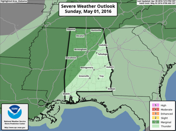
FOR SUNDAY: May looks to start off the way April ends with the threat of showers and storms. The SPC has a “marginal risk” covering the northwestern half of the state. This risk area includes Gadsden, Birmingham, Tuscaloosa, Huntsville, Cullman, and Muscle Shoals.
Sunday will be a rather warm and muggy with showers and storms once again a possibility. Tomorrow will be very similar today, with most of the day expected to be dry, but showers and storms will occur. Due to the unstable air mass, specific start and stop times are nearly impossible to pin point, but have the rain gear close to hand tomorrow. The race out at Talladega, should be able to be completed tomorrow, but of course a weather delay cannot be ruled out.
Category: Alabama's Weather


