Warm Afternoons Through Mid-Week
BIG WARM-UP: Many locations are down in the upper 40s this morning, but we warm to near 80 degrees in most places this afternoon. Clouds will slowly increase during the day.
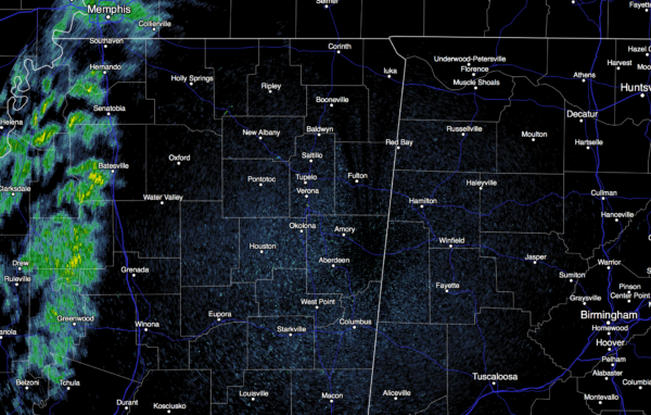
On radar, we note showers over West Mississippi as the day begins…
We will keep an eye on this rain as it moves in our direction; the air in the low levels across Alabama is very dry, and there is a good chance this rain will slowly disappear from the radar as it gets close. But, the high resolution HRRR model does suggest a few raindrops could slip into Northwest Alabama this afternoon. Out of respect to this idea, and dew points rising into the 50s over the western part of the state, I think we will insert the chance of a few sprinkles this afternoon, mainly west of I-65, and north of I-20. Most places stay dry.
TOMORROW: Another warm day with a high around 80 degrees; expect a mix of sun and clouds with only a small risk of an afternoon shower over the northern third of the state.
THURSDAY/FRIDAY: Rain chances will increase Thursday afternoon and Thursday night as the “omega block” breaks down, and the upper trough over the western U.S. weakens and lifts out. We will need to hang on to the risk of rain into Friday, at least during the morning hours, before drier air returns later in the day Friday.
Rain amounts of around 1/2 inch are likely, and we don’t expect any severe weather problems with very little surface based instability and weak upper support.
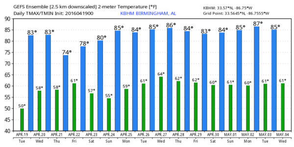
THE ALABAMA WEEKEND: Delightful weather with sunny pleasant days and clear cool nights… the high Saturday will be in the upper 70s, followed by low 80s Sunday.
Dry weather continues Monday, but showers and storms should return late Tuesday into at least part of the day Wednesday. And, for now, the severe weather threat looks rather low. See the Weather Xtreme video for maps, graphics, and more details.
HONDA INDY GRAND PRIX WEEKEND: There will be eleven races at Barber Motorsports Park Friday through Sunday; the main weather issues will come Friday when rain will likely linger into the morning hours. There is a good chance the rain will end by midday Friday, followed by gradual clearing during the afternoon. Then, nearly perfect weather Saturday and Sunday with sunny days and warm afternoons. Get ticket information here.
AT THE BEACH: Dry weather for the Gulf Coast from Panama City Beach over to Gulf Shores through tomorrow, but showers and storms are possible Thursday afternoon into Friday. Sunshine returns in full force over the weekend; highs will be mostly in the 70s, and sea water temperatures are in the mid to upper 60s. See a very detailed Gulf Coast forecast here.
WEATHER BRAINS: Don’t forget you can listen to our weekly 90 minute netcast anytime on the web, or on iTunes. This is the show all about weather featuring many familiar voices, including our meteorologists here at ABC 33/40. Scroll down for the show notes on the new episode we recorded last night.
CONNECT: You can find me on all of the major social networks…
Facebook
Twitter
Google Plus
Instagram
I have a weather program this morning for the pre-K group at Gardendale’s First Baptist Church, and then I will be speaking at Bevill State Community College in Jasper. Look for the next Weather Xtreme video here by 4:00 this afternoon. Enjoy the day!
Category: Alabama's Weather


