Monday Midday Nowcast For Alabama
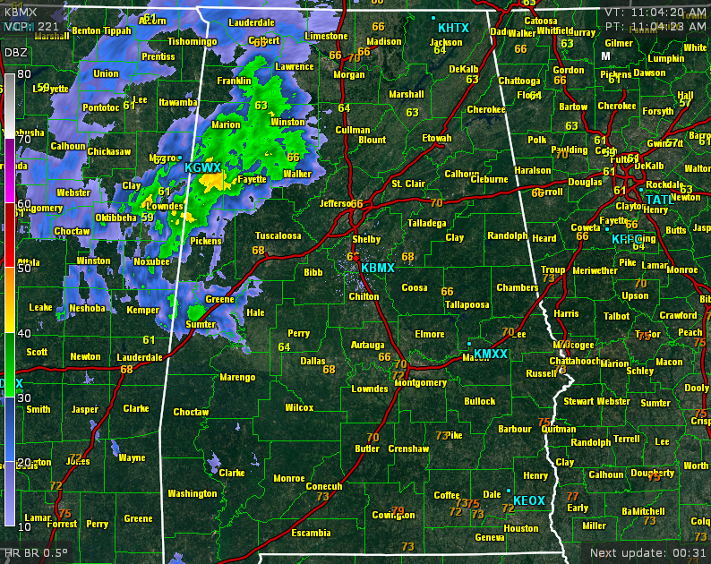
At 11:00 AM, light to moderate rain was making its way into the western counties of Alabama. Counties west of the I-65 corridor, and along and north of the I-20 corridor are currently experiencing rain. At this moment, there are no lightning strikes on the radar.
Temperatures across the area at this moment are mostly in the mid to upper 60s from the I-85 corridor to the AL/TN state line, with 70s from Montgomery southward. Dewpoints across the state are in the 40s and 50s. Highs are expected to reach the lower and mid 70s for today.
UPCOMING STORM SYSTEM: Storms are progressing across the extreme northeastern corner of Texas, much of central Arkansas, north and central Louisiana, western Tennessee, and northern Mississippi. There is currently one severe thunderstorm warning in effect for Little River, Miller, Sevier counties in Arkansas, McCurtain county in Oklahoma, and Red River, Morris, Titus, and Bowie counties in Texas. Main threat from this storm is damaging winds of 60 MPH and quarter-size hail.
SEVERE RISK: There is a “marginal risk” of severe weather for the extreme western counties of Alabama for the overnight hours tonight through the early morning hours on Tuesday. With very little instability, and the main upper support to the north, the overall severe threat looks low.
LATER TODAY & TONIGHT: While you may get some light to moderate rain during the daytime hours today, showers and thunderstorms will become more widespread tonight. It should be a good soaking rain, as amounts could be as high as 1 inch.
TOMORROW: Rain should be ending for the northern-half of the state by morning, with shower and thunderstorm activity shifting to the south by the afternoon. Highs should reach the upper 60s to near 70.
Category: Alabama's Weather
About the Author (Author Profile)
Scott Martin is an operational meteorologist, professional graphic artist, musician, husband, and father. Not only is Scott a member of the National Weather Association, but he is also the Central Alabama Chapter of the NWA president. Scott is also the co-founder of Racecast Weather, which provides forecasts for many racing series across the USA. He also supplies forecasts for the BassMaster Elite Series events including the BassMaster Classic.Subscribe
If you enjoyed this article, subscribe to receive more just like it.


