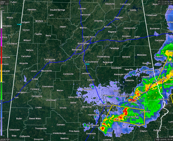
Late Evening Update On Tonight’s Event
Storms that are still in the state are lined up along the I-85 corridor from the GA/AL state line, back to just east of Montgomery, and down to Butler county, just east of I-65. There is currently a severe thunderstorm warning in effect for Bullock, Macon, and Montgomery counties until midnight CDT.
There is still a limited severe threat for areas west of the line of storms. The main threat will be from damaging straight-line winds and quarter-size hail. Heavy rain and frequent lightning can be expected with this line of storms.
Back to the west of the line, the severe threat is over and skies will start to clear out during the overnight hours. This will allow the low temperatures to drop down into the upper 40s to lower 50s for the northern half of the state.
Damage reports are still coming in from across the state. Multiple reports of trees and power lines being knocked down, along with damage to cars and fences from tonight’s storms. The total extent of damage will probably not be known until daylight.
Category: Alabama's Weather, Severe Weather


