Storms Approaching Birmingham; Not Severe At This Time
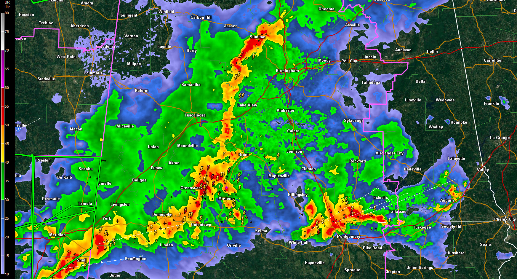
Strong storms are approaching the Birmingham area, but they are not severe at this time.
The line of storms extends from near Warrior to Sumiton to Borookwood in Tuscaloosa County to near Greensboro in Hale Coumty.
They will reach downtown Birmingham between 930-945, Bessemer and McCalla around 930 and Alabaster around 945 p.m.
They will have winds of 30-40 mph, torrential, flooding rains and deadly lightning.
There was a severe thunderstorm warning for eastern Hale County but it just expired.
Tornado watches continue for all of Central Alabama until 1 or 4 a.m., depending on where you are. The newer watch (until 4, covers the easternmost counties.
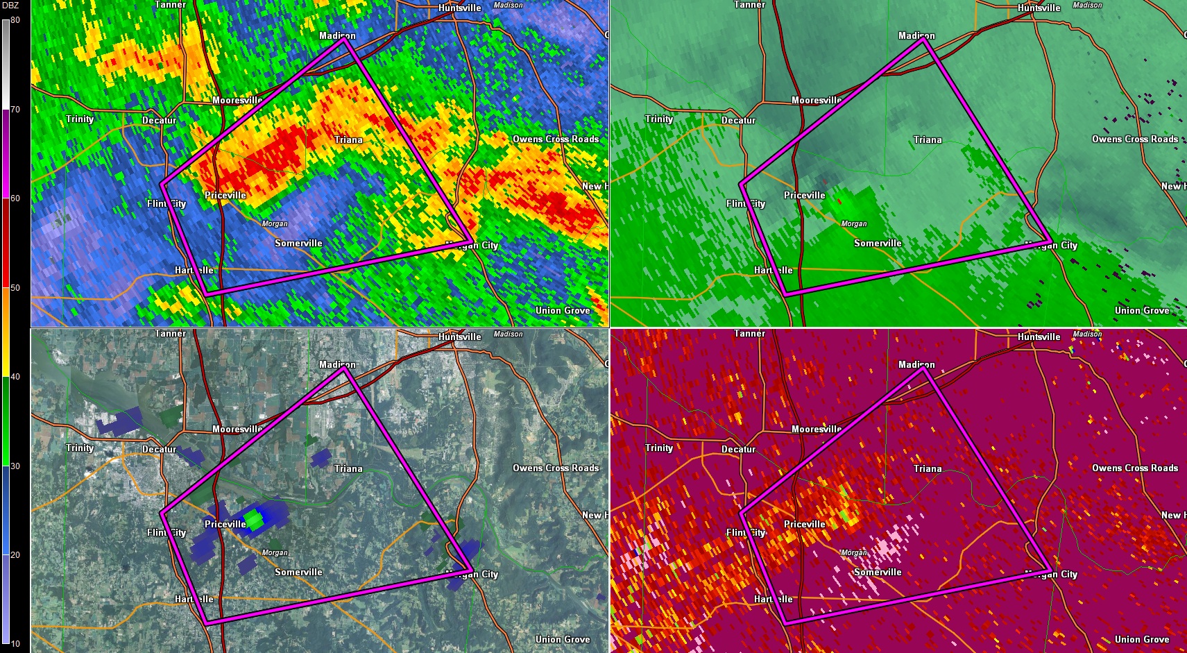
REPORT FROM NORTH ALABAMA
There is a tornado warning up round Decatur and Hartselle. A radar indicated tornado is near Hartselle.
Category: Alabama's Weather, Severe Weather
About the Author (Author Profile)
Bill Murray is the President of The Weather Factory. He is the site's official weather historian and a weekend forecaster. He also anchors the site's severe weather coverage. Bill Murray is the proud holder of National Weather Association Digital Seal #0001 @wxhistorianSubscribe
If you enjoyed this article, subscribe to receive more just like it.


