Showers For Part Of The Weekend
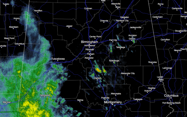
RADAR CHECK: As expected, most of the rain across Alabama today has been over on the western side of the state…
There are a few showers over East Alabama, but they are widely spaced. The sky is mostly cloudy, and temperatures are in the low 70s in most places. The best chance of rain tonight will remain west of I-65, across West Alabama, with only isolated showers for the eastern counties.
TOMORROW: The upper low that has been over Mexico this week will finally lift out and weaken. A decent part of the morning should be dry (for the northern half of Alabama), but we expect to see an increase in the number of showers and thunderstorms tomorrow afternoon and tomorrow night. The rain won’t be continuous, and there is no risk of severe storms or flooding. Just occasional showers with a little thunder possible at times. The day will be cloudy and mild with a high in the 70-75 degree range.
SUNDAY: The trough lifts northeast of Alabama, and showers will end from west to east during the day. A decent part of the state should be dry by Sunday afternoon, with only lingering showers across the northeast counties. The high will be well up in the 70s.
NEXT WEEK: We will maintain the risk of a few scattered showers Monday, mainly over Northeast Alabama, then Tuesday looks warm and dry with potential for a high in the 80-85 degree range…. it should be the warmest day so far this year for most places. Then, a cold front will arrive Tuesday night with a risk of widely scattered showers; rain amounts if any will be very light and spotty due to the lack of moisture.
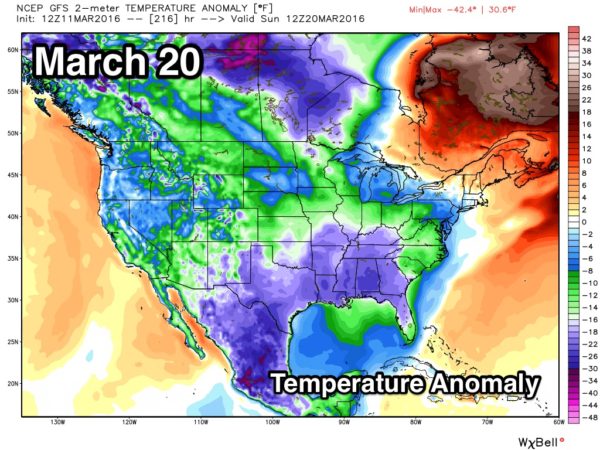
Then, Wednesday and Thursday look dry with a good supply of sunshine both days; highs will be close to 70 degrees. The latest (12Z) GFS run shows showers returning to the state Friday (March 18)… and then sharply colder air slips in here for the following weekend. A very real chance we get down into the 30s by Sunday morning March 20. See the Weather Xtreme video for maps, graphics, and more details.
AT THE BEACH: Showers and storms are a good possibility tomorrow from Panama City Beach east to Gulf Shores, but the weather trends drier by Sunday and early next week. See a very detailed Gulf Coast forecast here.
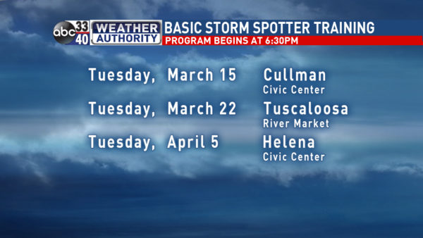
STORM SPOTTER TRAINING: We are offering basic SKYWARN training at several locations across North/Central Alabama in March, followed by the big event, Storm Spotter Xtreme on Saturday, April 9 at the BJCC from 9am to 2pm. This will feature both the basic and advanced SKYWARN classes, along with a session from Kevin Laws of the Birmingham NWS office. And, if you come, you get free admission to the Alabama International Auto Show, going on at the BJCC that same day. There is no cost and no need to register. Just show up with a curious mind. Kids 10 and older will also enjoy this if they love weather and want to learn more. Please help us make the severe weather warning process better!
WEATHER BRAINS: Don’t forget you can listen to our weekly 90 minute netcast anytime on the web, or on iTunes. This is the show all about weather featuring many familiar voices, including our meteorologists here at ABC 33/40.
CONNECT: You can find me on all of the major social networks…
Facebook
Twitter
Google Plus
Instagram
I had a great time today visiting with the students at Myrtlewood Elementary School in Fosters… look for them on the Pepsi KIDCAM today at 5:00 on ABC 33/40 News! My next Weather Xtreme video will be posted here Monday morning by 7:00… Brian Peters will have the video updates tomorrow and Sunday. Enjoy the weekend!
Category: Alabama's Weather


